Author: Ian Fulgar

  • Philippine Architecture

    Philippine Architecture

    The beauty of Philippine architecture reflects its history and culture. It is a blend of indigenous, Chinese, Spanish, American, and Asian influences with a mixture of Western-style buildings. The residences of its various communities, the churches and mosques they have constructed, and the structures built to suit the geophysical conditions, progress requirements, and the people’s ambitions.

    The current Philippine architecture is an outcome of authentic growth that has enriched the reception of numerous influences. It began with the impact of the Malay brothers and continued to the Spanish colonial, American Commonwealth, and modern times. The Philippines is now a unique architectural melting pot with an occidental touch.

    The Fusion And History Of Philippine Architecture

    Leandro Locsin, the late national architect, once stated that Philippine architecture was elusive because it fully benefits from modern technology but is still a mixture of different foreign influences over the centuries. These include the Philippine culture of the Malay and vestiges from earlier Hindu tendencies, more than 300 years under Spanish dominance, almost 50 years of American control, and the Arab and Chinese influence through commerce and trade throughout the centuries. The result may have been a hybrid. It is an entirely new configuration that may include a remembrance or frame of the past but modified or articulated in terms of its importance today.

    The Philippine’s architectural landscape features a contrast between small, traditional huts made of wood, bamboo, and nipa and the large Spanish colonial churches and convents with their heavy “earthquake-proof” baroque style; American mission-style architecture and the buildings of commerce in the 20th century; and the modern, but still evolving, concrete and glass structures of today’s cities.

    Tribal And Cultural Fidelity

    The construction of rural native huts has not changed much over the centuries. While the design is different from region to region, the most common feature is a steep roof that covers a living space of one or two rooms. These roofs can be raised on stilts or posts one to two meters above the ground or shallow water. Some huts include balconies. Split bamboo floors allow dirt and food scraps for pigs and chickens to pass through. Tenants use the space below the hut as storage or a workshop. It also allows air to circulate, protects the inhabitants from snakes and rodents, and protects against insects, floods, and other threats. Corrugated galvanized iron eventually replaced modern-day roofs, which are more expensive but last longer. However, the metal roofing component would make the house interior hotter to live in and seemingly unappealing on the exterior. 

    Bahay-Kubo (cube house or nipa hut) is a traditional Filipino house found in the lowlands. The original nipa house was a single-room dwelling. It gradually evolved into a two-story structure with concrete floors, wooden slats, and iron sheet roofing. 

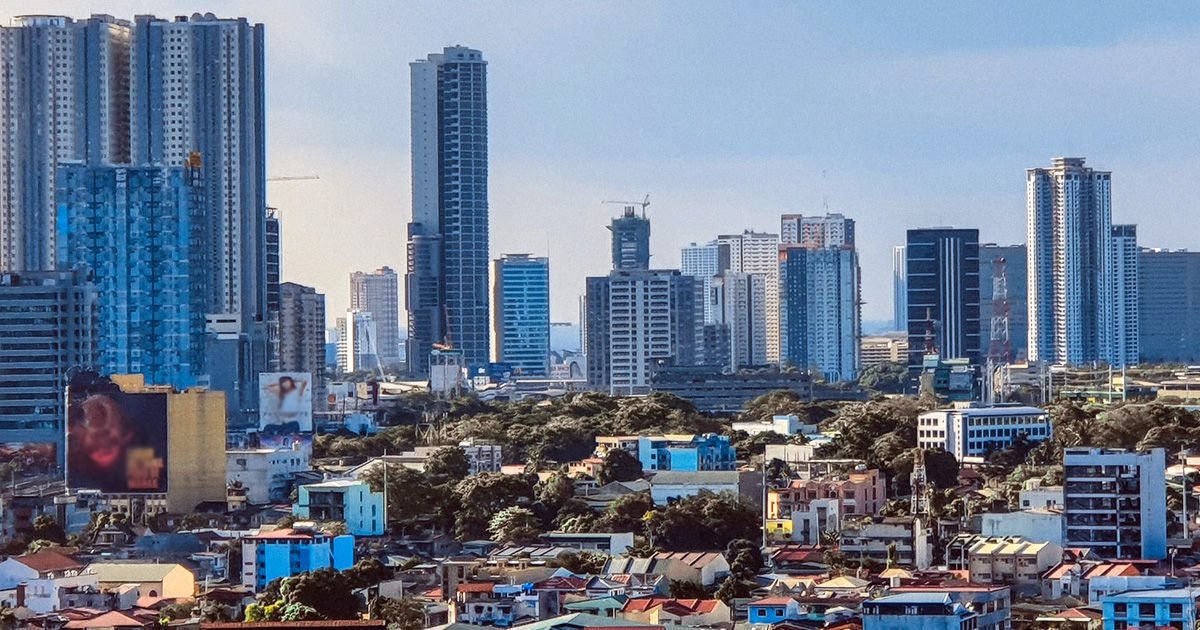
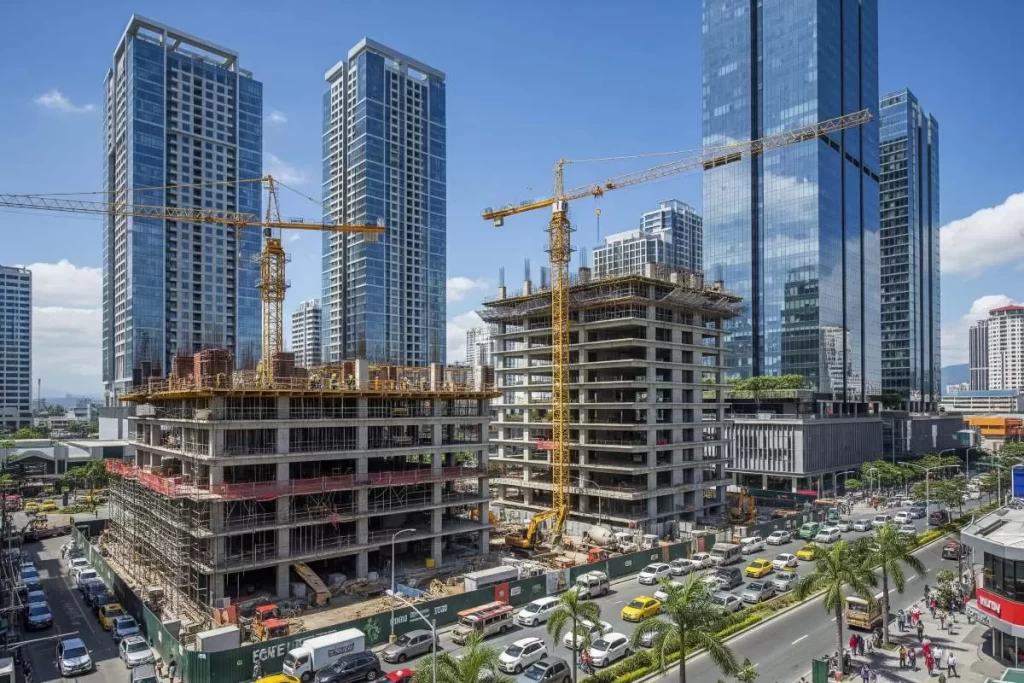
    A historic Manila church with ornate stone architecture stands in contrast to nearby modern high-rise buildings of glass and steel, illustrating the dynamic relationship between Philippine heritage architecture and contemporary urban development.
    The enduring presence of a historic Manila church stands as a solemn witness to the city’s evolving skyline. Rising beside it, sleek towers of glass and steel proclaim the aspirations of modern architecture. The juxtaposition reveals a visual dialogue between the city’s sacred past and its dynamic urban present. This spatial relationship reflects the cultural resilience and adaptive growth of the metropolis.

    In contrast, affluent Filipinos built fine houses in the 19th century. They used brick or solid stone foundations with an overhanging wooden upper story adorned by balustrades.

    Environmental Conditions In Various Regions

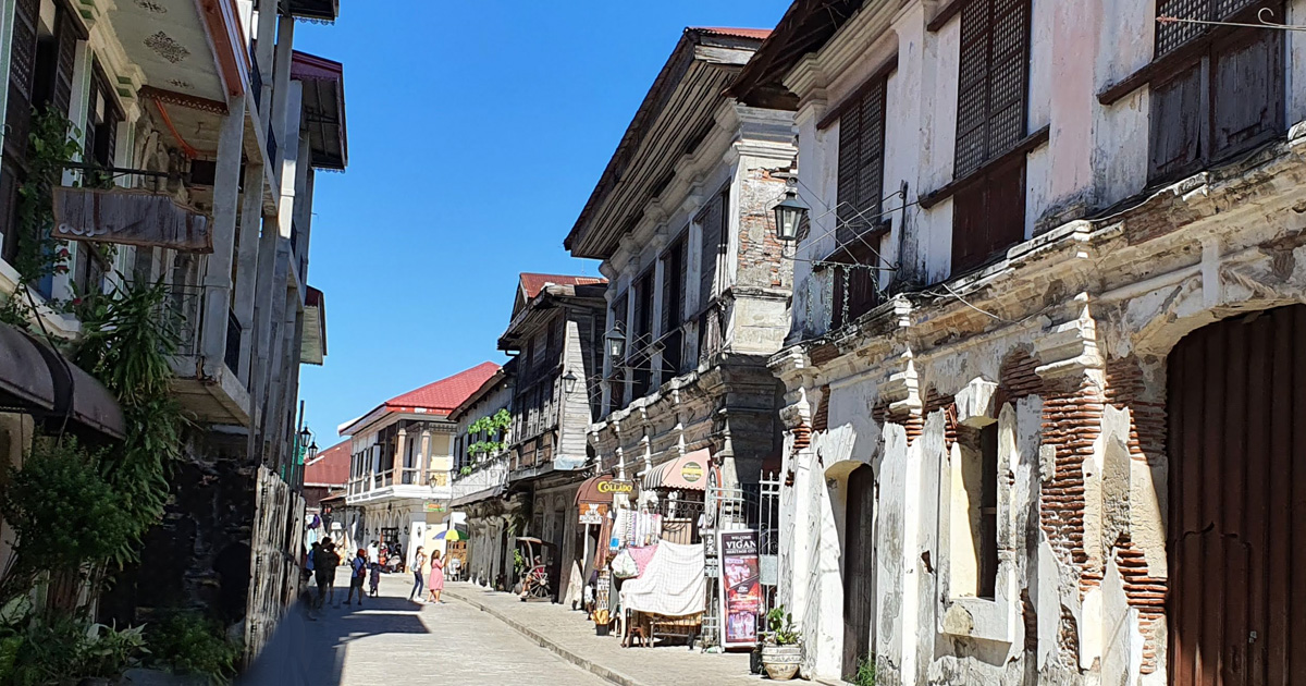
    Good examples of early Philippine architecture are the Rizal house in Calamba and Laguna and the Luna house at Badoc, Ilocos Norte. The best Spanish quarters are still in existence in Vigan, Ilocos Sur, and Taal in Batangas. There are also notable old houses in Ilo-ilo, Cebu, and Manila.

    In other regions of the Philippines, other than the lowland Bahay Kubo, have distinct styles of tribal architecture. This influence results from culture and, in some instances, climate and environment. Despite indigenous materials, houses constructed in the Cordillera Mountains’ upland areas are more secure.

    The lowland Bahay Kubo has ventilation on all sides. However, mountain huts like binangiyan in Kankanay, fayu in Bontoc, binayon in Kalinga, bale in Ifugao, and others are more well-insulated with natural materials. Maranao’s torogan is a royal residence and has elaborate ornamentation. The relatively isolated areas of the Batanes Islands in the Philippines are typically windy. This condition has led to unique traditional Philippine architecture in the area. The Ivatan’s rakuh has a solid foundation to withstand the typhoons that frequent the site. A meter-thick rubble work and a dense thatch roof form this native house.

    Colonial Forces In Philippine Architecture

    Antillian architecture was introduced to the world by the Spaniards, who arrived in 1571. Although not designed for the hot tropics, European architecture was adapted to a unique Filipino style via Acapulco in Mexico. This style is rooted in Central America rather than Spain. After establishing the conquest of the islands, religious structures were necessary to establish Christianization and support the growing number of religious organizations. 

    Even though they are not as striking as those found in Europe and Latin America, the Philippine architecture in colonial churches have a unique sense of their own. The Ilocos Regions are home to some of the most well-preserved colonial churches in the nation. They also include Batangas, Laguna,the Visayan Islands, Panay, Cebu, and Bohol. Anonymous friar architects often designed these colonial churches and constructed them between 1600-1750. The proponents first assembled many of these religious structures with bamboo and nipa. But the friars realized that they needed more elegant buildings to instill awe and caution against the alarming threat of earthquake and fire. They built massive structures, regardless of technical and material limitations, taking many years or even decades to construct. These structures have survived until today.

    Formalizing Workmanship and Methodologies

    Master-builders from China and the Philippines eventually took over the friars’ work. Sometimes, these craftsmen left their mark in the decorative motifs. These included tropical vegetation by Filipinos and lions or dragons by Chinese. 

    Built with an adjoining convento (priest house and office), the churches also had an attached or detached belfry (as in the Ilocos Region, where the belfry was constructed a few meters from the church structure to prevent it from collapsing in earthquakes) and walled forecourt. Three-story tall belfry afforded a great view of the sea and surrounding land. Watching over enemies used the more elevated advantage. 

    An ancient stone fortress with weathered walls, arched gateways, and defensive bastions stands prominently under tropical sunlight, representing the enduring legacy of Philippine architecture from the colonial era to the present.
    An ancient stone fortress stands as a sentinel of history within the evolving narrative of Philippine architecture. Its weathered walls bear the marks of centuries, embodying the endurance of colonial-era craftsmanship. Within its bastions, the fusion of strategic military design and cultural adaptation becomes evident. This enduring structure offers a visual link between the Philippines’ fortified past and its continued architectural evolution.

    The style and amount of exterior and interior decoration in each church are diverse. Many churches have an intricately carved façade and reredos that form the backdrop for the altar. Some churches remain original today, while others have suffered from tasteless renovations. Early proponents built many churches on the foundations of earlier ones through successive restorations and renovations. 

    Defensive Planning As Part Of Philippine Architecture

    Military architecture was also a part of the Spanish colonial period, as seen in the numerous fortifications built throughout the archipelago. In Manila, Intramuros is the most important. Intramuros, which means “inside the walls”, is a defense network that includes raveling and bulwarks to defend the Spanish city against attack. Fort Santiago, named after Spain’s patron saint, is the leading military outpost.

    The Celebrated Bahay Na Bato In The Philippines

    The Bahay na Bato, a typical Filipino noble house, is derivative of the characteristic Filipino hut. It uses more robust materials to build its core component and continues the principles of open ventilation and high apartments found in its predecessor. 

    The name means ‘Stone House’ in Tagalog and is mainly constructed out of stone rather than traditional bamboo. The Bahay na Bato was the first to develop commercial structures to serve the neighborhood.

    Bahay Na Bato may alternatively comprise a stone or brick foundation and a hardwood upper level with a roof coated in clay tiles or galvanized steel in later years. Unique in architecture, the window opens from mid-level to floor and ceiling. These openings allow the tropical breeze to flow freely through the house, ventilating it. The piano noble, an upper level of the house, contains the most luxuriously furnished apartment sections. Situated just below, storage and carriage depots expanded at the ground floor.

    A traditional Bahay na Bato with a stone base, hardwood upper floor, clay tile roof, and wide capiz shell windows stands in a tropical setting, showcasing the evolution of the Filipino noble house into a durable and climate-responsive residence.
    The Bahay na Bato stands as a refined evolution of the ancestral Filipino dwelling, uniting tradition with enduring craftsmanship. Its stone foundations and hardwood upper floors reveal an architectural form adapted to both social stature and tropical climate. Broad window openings invite the monsoon winds to circulate freely through its interiors, creating a living environment in harmony with nature. The structure continues to embody cultural memory while serving as a functional response to its surroundings.

    Early Township Developments

    The Spanish period also produced schools and hospitals. (Ateneo Municipality, University of Santo Tomas Colegio de Letran Hospital de San Juan de Dios, University of Santo Tomas). Although they were often attached to the church’s structure, they evolved after developing tropical baroque architecture.

    The 1887 Philippine Revolution resulted in the country declaring independence from Spain. However, as part of the post-Spanish-American War settlement between Spain and the United States, power was transferred from Spain to the United States. 

    In 1898, the Americans arrived on the islands. The American arrival created a new breed of Philippine architecture. The establishment of civil government was one of America’s most important contributions to the country, resulting in government buildings’ construction, from the local level to the municipal. Every community was home to government houses. These government houses were designed most dignified and resembled Greek or Roman temples with porticoes, pediments, and other details.

    The revival period, which was popular around the turn of the century, became the most prominent architectural term of the era, as seen in buildings such as the Government Post Office Building and the Legislative Houses. 
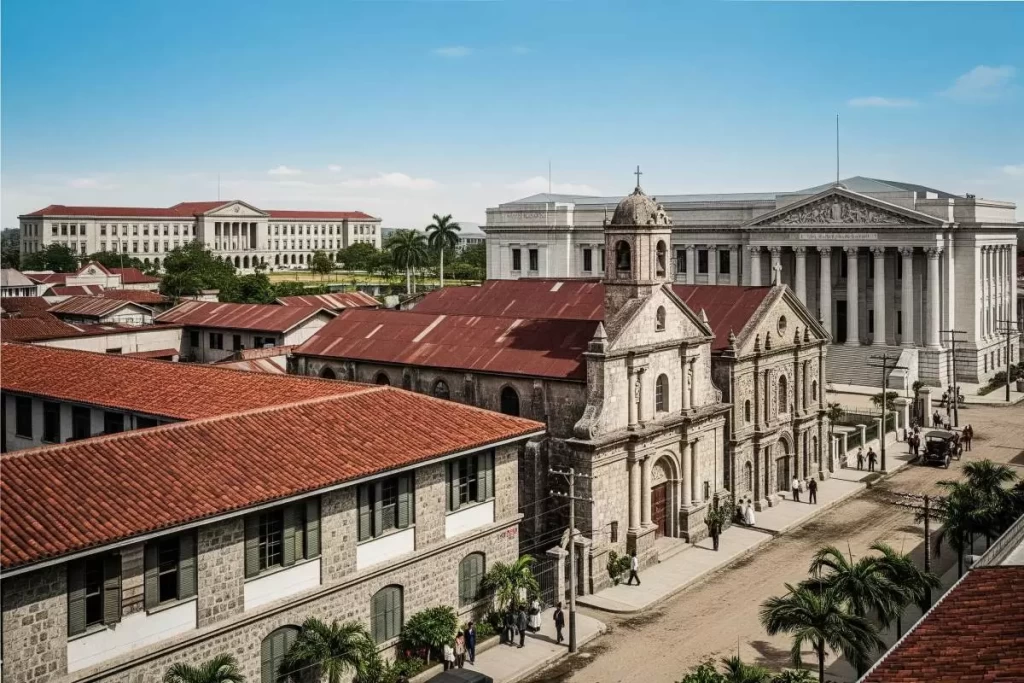
    A colonial-era government building with neoclassical columns, a grand portico, symmetrical stone facade, and ornate pediment rises under a clear tropical sky, representing the civic ideals and monumental character of Philippine architecture during the American period.
    The emergence of civic structures during the colonial transition period marked a pivotal chapter in the evolution of Philippine architecture. Inspired by classical Greek and Roman ideals, these buildings embodied dignity, permanence, and authority. Their stately porticoes, symmetrical facades, and ornate pediments reflected the aspirations of a new civic order. In their presence, the architectural language of the archipelago expanded beyond ecclesiastical influence toward a vision of statehood and progress.

    The American regime also made education the main thrust of its policies. The University of the Philippines, recognized as one of the earliest and most prestigious state universities in Southeast Asia, opened as a public university in 1908.

    The City Beautiful Movement

    The military government established American rule in the islands and invited Daniel Burnham, a Chicago architect, and town planner, to help develop the city. He also found a summer capital in Baguio. Burnham’s arrival in Manila led to the creation of the Burnham Plan, which identified Manila as a unique European city in the tropical territories. He dutifully opposed the idea of developing local architecture according to the existing western style. As suggested, the type of architecture differs only slightly from the accustomed Philippine architecture simultaneously, as illustrated by The Manila Hotel. New structures maintained traditional motifs but were composed of more dependable materials like concrete. This type of Philippine architecture remained popular even after the turn of the 21st century.

    Embracing The New Culture With Deep Traditions

    This eclectic style, which combines historic techniques with modern ones, is also evident in many of the new commercial establishments in the area, such as the Regina Building on historic Escolta. Art Nouveau also emerged in the central business district (Uy-Chaco Building at Calle Rosario and Plaza Cervantes) and the stately homes of the wealthy (Casa de Aristonbautista in Calle Barbosa).

    From the middle of the 20th century to the end of the Second World War, Art Deco was the bi-word for Philippine architecture. Works created during that time are Metropolitan Theatre at Plaza Aroceros and the Perez-Samanillo Building, Crystal Arcade, Capitol Theatre nestled along Escolta, State, Avenue Theatres, and Avenida Rizal and Lide and Times Theatres along Quezon Boulevard, and among others.

    Rebuilding Philippine Architecture From The War To Modern Era

    After the second world conflict, there was nothing left but destruction. There was a period of rebuilding. Modern Philippine architecture was born using the International Modern Style’s simple, straight lines as its primary mode of expression. 

    With the Filipinization in architecture, a new type of Philippine architecture was born by the 1970s. The resurgence of traditional elements served as the impetus for developing the Filipino style. The Bahay Kubo and the charming design of the Bahay na Bato became trendy architectural styles imitated and modified. This adaptation can be seen in Batasan Pambansa and BLISS Housing projects. In the 1980s, Post Modernism reshaped the country’s architectural style. This movement is a return to some degree of classical architecture’s romanticism. 

    Today, Philippine architecture thrives with the growth of the real estate industry, and the introduction of more high-quality architectural styles responding to the country’s opening to the rest of the globe.

  • National Museum Of The Philippines Reservation In 2022

    National Museum Of The Philippines Reservation In 2022

    The National Museum of the Philippines is presently entertaining reservations and visits. The museum welcomes fully vaccinated individuals and tourists aged 18 and under as long as an appropriately vaccinated adult accompanies them. Visitors must have their vaccination cards and identification with them. Additionally, all guests must reserve online and book slots at least one day before arrival. Walk-in guests who do not have prior bookings will be refused entry. The upside is, that admission is free. Reservations need to be accomplished at least one day before your planned visit at reservation.nationalmuseum.gov.ph. Visitors may schedule a single trip or a group tour of four companions for either the AM (9-12) or PM (1-4) session.

    The facade of the National Museum of the Philippines stands prominently under a bright sky, featuring neoclassical columns, wide stone steps, and a Filipino flag waving gently in front, representing an architectural landmark and public institution accessible through advanced booking at reservation.nationalmuseum.gov.ph.
    The National Museum of the Philippines opens its grand halls once again, inviting a renewed public engagement with the nation’s cultural and historical patrimony. Carefully guided protocols now shape the visitor experience, balancing accessibility with collective well-being. Entry remains free, yet is governed by an online reservation system that requires prior booking and proof of vaccination. This convergence of heritage, health consciousness, and digital facilitation underscores a reimagined public space within contemporary civic architecture.

    What To Expect

    The National Museum is comprised of the National Museum of Natural History, the National Museum of Anthropology, the National Planetarium, and the National Museum of Fine Arts, in addition to museum branches located around the country. Besides, it serves as an educational, cultural, and scientific organization, hosting lectures, interviews, and publications, and conducting numerous research initiatives.

    Because the museum complex is so large, visitors select areas of interest. Numerous excursions include visiting the National Museum and other sights in Manila, including the Ayala Museum, Casa Manila, and Fort Santiago. Passengers on cruise ships and layovers may arrange for a personalized tour. Public transit lines with routes passing near the museum include jeep, bus, train via LRT 1, and water jeepneys.

    The National Museum of Natural History

    The National Museum of Natural History is an excellent place, to begin, after extensive renovations. It shelters priceless artifacts and specimens in botany, geology, and zoology. Among the museum’s most renowned exhibits is the Tree of Life, the skeleton of the Philippines’ most enormous captive crocodile named Lolong, the Rainforest Diorama, and the Mangrove Diorama. Moreover, some of the displays are interactive.

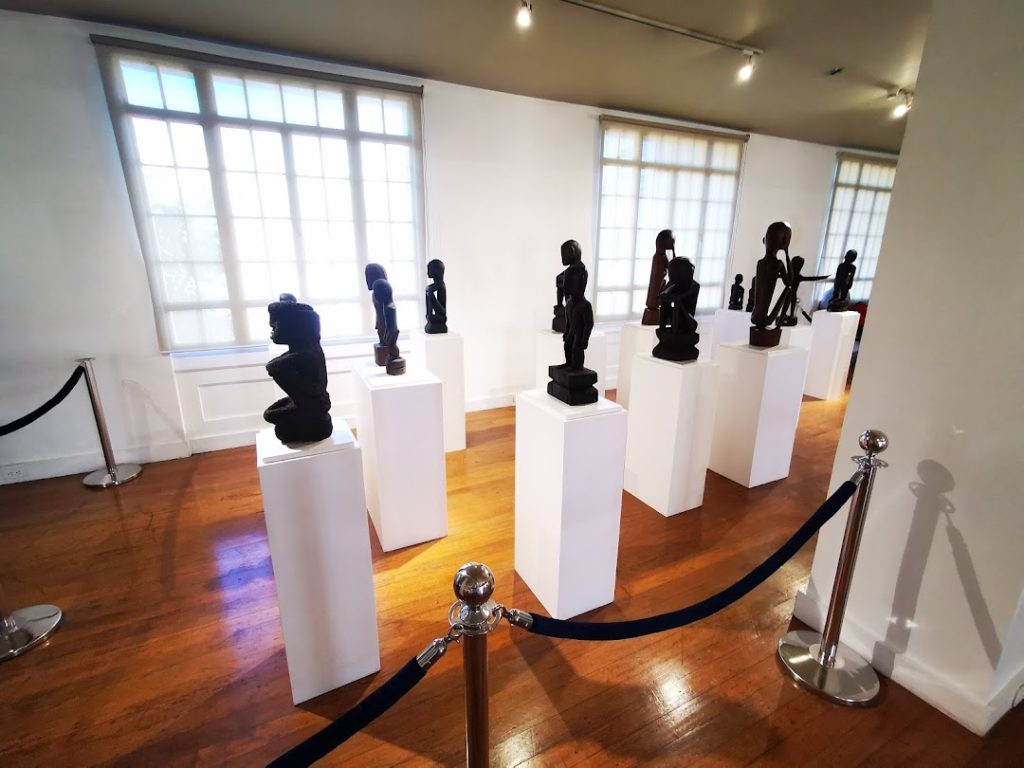
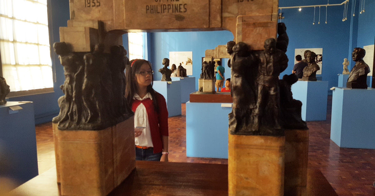
    A row of historic sculptures stands in solemn formation inside the National Museum of the Philippines, showcasing intricately carved stone figures that reflect the cultural and ecological focus of the museum’s natural history collection.
    The National Museum of the Philippines has expanded its narrative with the revitalized National Museum of Natural History. Within its halls reside sculptural elements that embody the nation’s reverence for its natural legacy. These carved forms transcend aesthetic function, serving as conduits of biological, ecological, and geological memory. They do not merely decorate space—they define its intellectual and cultural purpose.

    The National Museum of Anthropology

    Formerly the Museum of the Filipino People, The National Museum of Anthropology is housed in the five-story former Department of Finance Building, influenced by NeoClassicism architecture. As the National Museum’s second structure, it serves as a cultural center, leading the research and preservation of the nation’s rich artistic, historical, and cultural legacy, as well as the restoration and rebuilding of our nation’s history. It was constructed in 1940 in the Federal architectural style by Arch. Antonio Toledo of the Bureau of Public Works. He also planned Manila’s administrative facilities under the American colonial authority.

    The National Planetarium

    The National Planetarium was founded to communicate astronomical knowledge using a variety of platforms and technologies, including full-dome digital and mobile planetarium performances, talks, demonstrations, exhibits, and actual celestial observations. Its distinguishing characteristic is the lifelike depiction of heavenly bodies, which captivates the curiosity and stimulates the imagination of aspiring Filipino astronomers.

    The first National Planetarium opened on September 30, 1975, under the direction of the National Museum of the Philippines, pursuant to President Ferdinand E. Marcos’ Presidential Decree No. 804-A. It was officially inaugurated and opened to the public on October 8, 1975. At the time, it was Southeast Asia’s largest planetarium.

    The National Planetarium’s most recent renovations started in 2016 and included a number of structural, technological, and program modifications. In January 2019, the freshly restored ethnoastronomy display reopened to the public.

    Juan Luna’s Spoliarium dominates a stately gallery in the National Museum of the Philippines, its monumental neoclassical composition illuminated by soft ceiling lights and surrounded by polished floors and muted architectural detailing.
    The legacy of the National Museum of the Philippines extends beyond its architectural presence and curatorial rigor. In its galleries, historical grandeur merges with national identity, where masterpieces such as Juan Luna’s Spoliarium evoke collective memory and evoke civic consciousness. Though the National Planetarium imparts astronomical understanding, the Museum itself anchors the celestial within the terrestrial—bridging the cosmos with culture. The juxtaposition of art and science within institutional architecture constructs a holistic national narrative.

    The National Museum of Fine Arts

    The National Museum of Fine Arts displays a collection of works by traditional Filipino painters. It was initially founded as the National Art Gallery in 1998 and is owned and maintained by the National Museum of the Philippines. It is situated across from the National Museum of Anthropology on Padre Burgos Avenue. Among the artists included in the collection are Juan Luna, Félix Resurrección Hidalgo, and Guillermo Tolentino.

    Ralph Harrington Doane, the American consultant architect for the Bureau of Public Works, and his associate Antonio Toledo initially conceived the facility as a public library. Construction started in 1918 but was halted multiple times due to financial constraints. The construction cost reached four million pesos and was completed on 16 July 1926. The neoclassical architecture was constructed as part of Daniel Burnham’s master plan for the development of Manila. The House of Representatives and The Senate offices occupied the second, third, and fourth floors, while the National Library settled at the ground level.

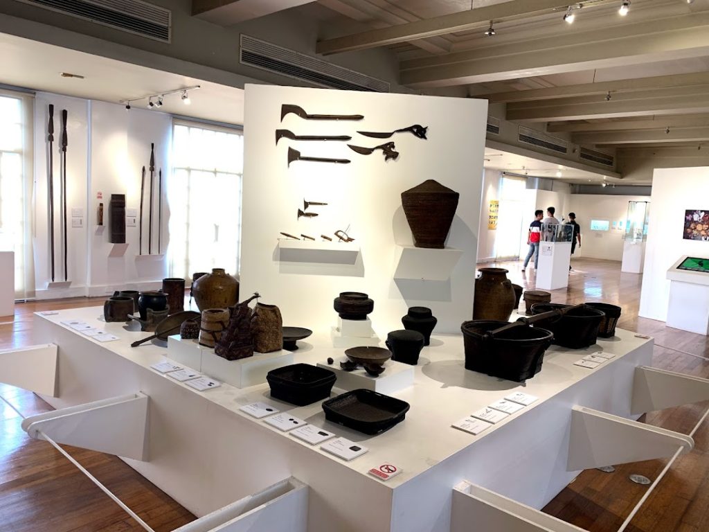
    A curated display of Filipino antiquities features various prehistoric pottery, stone tools, and ritual vessels housed within a dimly lit exhibition room marked by glass cases and soft directional lighting.
    The National Museum of Fine Arts stands as a cultural bastion, presenting a continuum of Filipino artistry from antiquity to modernity. Within its galleries, ancestral tools and earthenware reveal the ingenuity and rituals of prehistoric communities. These silent artifacts predate written history, yet they narrate civilizations shaped by craft, survival, and symbolic expression. Their presence affirms the architectural mandate of the museum as both a guardian and storyteller of cultural memory.

    How The National Museum Of The Philippines Began

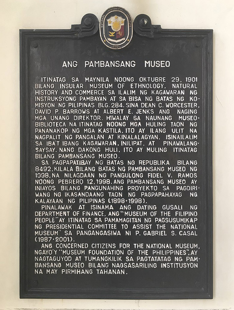
    The Museo-Biblioteca de Filipinas founded the National Museum of the Philippines on August 12, 1887. But it was destroyed by the American occupation of the Philippines in 2000. In addition, the National Museum was founded by the Insular Museum of Ethnology, Natural History, and Commerce on 29 October 1901.

    A metal commemorative plaque mounted on a polished stone surface features inscribed Spanish and English text detailing the historical founding of the Museo-Biblioteca de Filipinas and the Insular Museum of Ethnology, Natural History, and Commerce.
    The origins of the National Museum can be traced to the establishment of the Museo-Biblioteca de Filipinas in 1887, an institution devoted to the systematic collection and preservation of Filipino heritage. Though lost to war and shifting governance, its legacy laid the cornerstone for the country’s national memory. The eventual creation of the Insular Museum of Ethnology, Natural History, and Commerce in 1901 formalized this vision. These foundational institutions embodied early efforts to institutionalize Filipino cultural identity.

    The National Museum is a government-owned trust. It is an educational, scientific, and cultural institution that seeks to document, preserve, exhibit, and encourage the scholarly study of art and other specimens. It is responsible for establishing, managing, and developing museums throughout the nation, including the National Museum Complex at Manila and the National Planetarium.

    In addition, there are more than ten branches scattered throughout the country of the National Museum, which displays the roots and visual expressions of Philippine culture. 

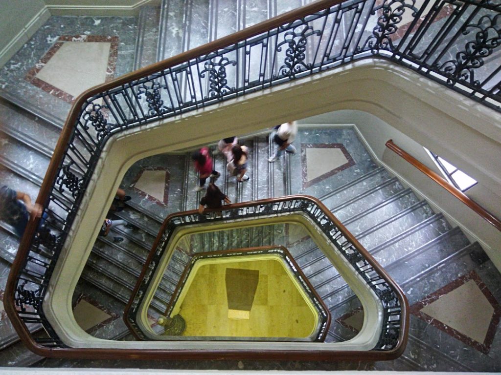
    A sculptural spiral staircase of polished concrete and metal handrails ascends within a softly lit interior, symbolizing the museum’s pursuit of cultural preservation and national heritage.
    Embedded within its architectural form is the museum’s quiet assertion of continuity and ascension. The spiral staircase, a recurring motif in institutional design, embodies the evolving pursuit of knowledge and the cyclical rediscovery of cultural roots. As visitors ascend, they trace not only a physical journey but also a metaphoric elevation into the layered realms of Filipino history, science, and art. Such spatial narratives are deliberately composed to resonate with the institution’s overarching mission.

    The Role Of The National Museum

    The National Museum of the Philippines develops and manages the country’s reference collection in cultural heritage in fine art, anthropology, or archaeology, as well as natural history in botany, zoology, paleontology, and geology. The museum promotes appreciation and research findings and technical, museological skills and knowledge through publications, educational and training programs, outreach, and other means. 

    The National Museum of the Philippines administers the enforcement of several cultural regulations. It also manages many culturally valuable properties, sites, or reserves. It is also the agency that coordinates the annual Museums and Galleries Month. This event takes place every year in October.

  • Forms Of Urbanism To Address The Metro Manila Congestion

    Forms Of Urbanism To Address The Metro Manila Congestion

    The concept of new urbanism revolves around building cities and towns centuries ago. They completed the sprawl with accessible public spaces, housing, and shopping within small distances and walkable streets and blocks. Although the term is relatively recent, it was introduced during the early 1980s (post WW2) when pedestrian and transit-oriented neighborhood designs were at their highest demand. Simply put, new urbanism holds outstanding importance on human-scaled urban design to future city evolutions.

    Tactical Urbanism, Short-Term Solutions For Long-Term Change

    Tactical urbanism is about taking action. Generally rapid, low-cost, and temporary urban “tactics” to make communities more dynamic and entertaining. Developers can easily duplicate these “tactics” in several places. It is no surprise that this kind of urbanization has exploded in popularity throughout the globe in recent years.

    Issues usually addressed by tactical urbanism involve minor fixes that spontaneously emerged in several communities commonly encountered by residents. Such difficulties include the lack (or even disappearance) of safer walkways, clear signage, walkable neighborhood parks, and, more broadly, a lack of solidarity and community connectedness, particularly along roadways and public places.

    Ecological Urbanism, Forging A Connection Between Ecology And Urban Systems

    The primary purpose of ecological urbanism is to develop “synthetic” solutions for connecting ecology and town planning without damaging the natural environment. Ecological urbanism, therefore, encourages the creation of “artificial ecosystem” cities that mimic the life-preserving qualities of natural ecosystems.

    A more specific manifestation of ecological urbanism is turning the linear, dead-end pattern of “energy-in-one-end” and “wastes-out-the-other” into a loop. Hence, a city adopting this strategy can even turn waste into energy.

    Landscape Urbanism, Restoring The Charm Of Building “Horizontally”

    As the name suggests, landscape urbanism refers to the planning and design of open spaces where landscape holds the highest importance. However, the landscape in this context does not necessarily refer to vegetation alone. Instead, it describes a designer’s ability to sense “a good place”.

    Instead of focusing on vertical developments of objects and buildings, landscape urbanism emphasizes the horizontal field, with open spaces at the core of planning and design for urban areas. It emphasizes performance over pure aesthetics, moves from pictorial to operational, and utilizes a sustainable systems-based approach.

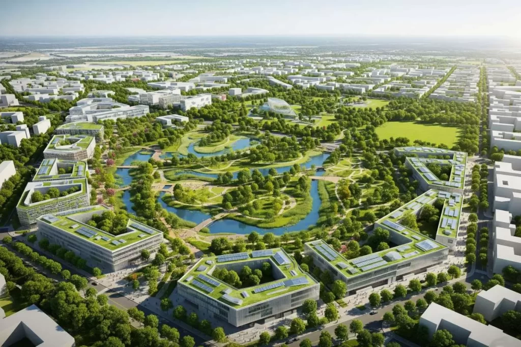
    An aerial view of a modern eco-friendly urban development showcasing wide open green spaces, interconnected pathways, water features, and low-rise buildings arranged with emphasis on the ground plane, illustrating the principles of urbanism through sustainable landscape design.
    Landscape urbanism situates the ground plane as the principal medium for design, shaping environments where spatial quality transcends the singularity of built forms. This approach redefines the role of open space in the contemporary city by giving precedence to ecological performance and systemic integration. Through this lens, urban territories evolve as layered terrains where social, cultural, and environmental forces converge.

    Unitary Urbanism, Making Spaces Usable Yet Memorable

    This form of urbanization considers multiple perspectives in sociology, psychology, and the arts to create a synthetic hypothesis that offers a solution to housing, recreation, and traffic. It focuses more on creating a memorable, transient micro-ambiance that combines art and science while ensuring that all elements are usable. This condition makes this form of city design “unitary”.

    Sustainable Urbanization, An Upgraded Version Of New Urbanism

    Sustainable urbanism promotes walkability and transit-friendly connectedness combined with high-performance buildings and infrastructure. An enhancement to this approach combines biophilic ideologies and compactness as its primary design values.

    Ironically, planners often place mass transit stations near military camps and exclusive gated communities in Metro Manila. The locations are of no use to nearby residents since they do not take public transport. On the other hand, the city pushes the regular working class into the corners of the metro, where more affordable options are available. Unfortunately, this follows the same segregation Filipinos have experienced during colonial times. The affluent are inside the walls of Intramuros, while the typical class is outside.

    Intelligent Urbanism, Looking Beyond Concrete Artefacts

    Also known as “smart urbanism” and “advanced urbanism,” intelligent urbanism is all about integrating culture and technology, wherein the focus relies on the process itself instead of the outcome. This principle believes that “making is thinking” just as how “thinking is making.”

    This form of city design follows ten principles, or “axioms”: (1) balance with nature, (2) preservation of cultural heritage, balance with traditions, (3) appropriate technology, (4) conviviality, (5) efficiency, infrastructural effectiveness, (6) human scale, (7) opportunity matrix, (8) regional integration, (9) balanced movement, and (10) institutional integrity.

    Although it shares ideals with transit-oriented initiatives, the objective is to improve the human condition and expand human potential rather than replace the vehicle. Hence, intelligent urbanism seeks to advance urban planning as a medium that promotes pedestrian walkways, people-friendly places, and public spaces where socially- and economically-diverse people can meet face-to-face regardless of their density.

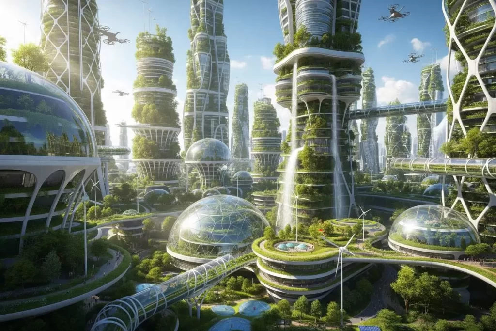
    A futuristic cityscape with towering buildings covered in lush greenery, elevated walkways, and expansive public plazas illustrating the principles of urbanism through intelligent integration of culture, technology, and sustainable design.
    Intelligent urbanism recognizes the city as a living construct where cultural heritage, environmental balance, and technological advancement intertwine. It places emphasis on process over outcome, allowing urban form to emerge from thoughtful making rather than predetermined imposition. Through its ten guiding axioms, it charts a framework that honors tradition while embracing innovation. Cities shaped by this principle become arenas of human interaction where movement, scale, and opportunity remain harmoniously aligned.

    Infrastructural City Planning, Understanding The Importance Of Technology

    In the urban realm, architecture and public spaces have always been well-appreciated, but now is the time to include technical infrastructure as an equally important component in an era of digital lifestyle and intelligent communities. This feature makes infrastructural urbanism a unique concept in urban planning.

    Instead of functioning on its own, infrastructural urbanism complements other forms of urbanism. The extension of sewage, water, and power networks is one of the long-standing concerns in unplanned settlements. As previously stated, infrastructure urbanism compensates for the flaws in urban planning in these types of communities.

    It understands that master planning is a “material practice”, which works in and among the world of things and not exclusively with meaning and image. This form of urbanism offers a new model for practice and a renewed sense of architecture’s potential to structure the future of a city.

    Evolving New Cities In The Philippines

    Many different types of urbanism may help unravel the growing concerns of Metro Manila. A paradigm shift from the traditional approaches can help the government and mainstream urban developers prioritize systems to complement and promote livability and growth. The fragmented faction of local agencies from housing to public works may have to consolidate into one national authority to take charge of national development and policing implementations.

    Then there should also be a focus on world-class land-use planning and zoning efforts. Quality land use planning and zoning are critical aspects of any city development. It guarantees the maximized use of land value and growth potential for generations to come. The quality of the environment, modes of mobility, transparency of services, dependable utilities, creation of parks, city expansions, community dignity, and how people access public areas safely are all critical attributes to uphold.

  • NFT Architecture: The Future Of The Unbuilt Environment

    NFT Architecture: The Future Of The Unbuilt Environment

    NFT architecture is a term used to describe architecture composed of non-physical forms. Digital building blocks can be manipulated and changed according to the creator’s vision. NFT architecture may also include electronics that allow interactive experiences with physical spaces and digital projections to create the illusion of presence in remote locations.

    In the future, physical buildings constructed from degradable and synthetic materials will have a more static and limited life. Shortly, facilities may not even have a physical form. They will exist as digital projections in real space – or at least this is what some architects predict.

    What are Non-fungible Tokens (NFTs)?

    A non-fungible token (NFT) is a unit of data that authenticates digital property as a unique asset and, therefore, is not interchangeable. To give a more explicit definition, examples of non-fungible assets are land or cars because they have singular qualities that add or remove perceived value. Money is fungible because a trade can exchange it for different denominations of equal value. For instance, two 50-peso bills can exchange for a 100-peso note. You can pay for an NFT with Ether (ETH), the unique cryptocurrency used in the open-source software platform and operating system Ethereum. The value of 1.0 ETH at the time of writing is $3657.78 (USD) or around ₱186,716.87 (PHP).

    NFTs have existed since 2014, and lately, they are becoming a mainstream medium for buying and selling digital media.

    What NFTs Represent

    NFTs represent various forms of digital media, such as images, videos, audio, illustrations, games, tweets, memes, and anything that can be stored digitally and may have some market value. They are like art collections, but you get a digital image file instead of a tactile oil painting in a wooden frame.

    But if NFTs are supposed to be unique, won’t it be easy to duplicate digital assets?

    One of the most remarkable characteristics of non-fungible tokens is their inability to be copied. While you cannot duplicate a painting, one may photograph it and share it with others. While it is illegal to reproduce a piece of music, it is possible to record it and share the recording with the world. NFTs are tokenized in a blockchain and cannot be falsified or stolen, unlike tangible property.

    Like authentic art prints are created, bought, duplicated, and sold, the value will always differ from the original. Right-clicking and saving NFT digital assets will not hold the data that authenticates it as part of the ETH blockchain.

    Artists market their digital work on a specific NFT online marketplace, depending on their media type. For instance, if an artist or company designs digital trading cards, Myth Market is the recommended online marketplace. Artists who create digital art, comics, or eBooks market their craft on Rarible.  But generally, NFT Marketplaces are platforms where artists, collectors, and cryptocurrency investors converge.

    Bridging the Gap Between Art and Architecture

    Architects would define architecture as composing, programming, and realizing the built environment within a physical domain. 

    Architectural projects are a product of service. In a professional setting, the service must comply with clients’ or the community’s needs. Any architectural study’s main thrust is the practicality of the design form and how it responds to factors. The art or self-expression of the architect is becoming less of a priority. This parody is the difference between art and architecture.

    A modern glass house with clean angular lines, expansive transparent façades, and a seamless integration with its landscaped surroundings, representing the balance of artistic design and functional architecture in Philippine real estate.
    Architecture exists within the realm of utility, balancing the demands of function with the aspirations of design. In the professional context, a project’s viability depends on its ability to serve specific needs and respond to external factors. Yet, within this framework, the architect’s personal artistry often takes a secondary role to practical considerations. This tension underscores the delicate relationship between architecture as a functional discipline and as a pure art form.

    The First NFT Architecture Sold

    Recently, artist Krista Kim signed up for an NFT marketplace called SuperRare, where she sold the first-ever NFT digital house for $500,000. She asked an architect to help her with the design and programming of the Mars House floor plans and model. The digital home sits on rocky mountain terrain. Translucent glass formed the walls, roof, flooring, and furniture. The artist intended the house to be an illuminated sculpture, so the floor and ceiling glowed with gradients of colors, saturating the reflective sets of furniture. Kim envisioned Mars House as having a meditative environment that she could easily access on her phone as an escape from the real world. She hopes the new owner appreciates the thought and effort she puts into her art.

    A video game development platform called Unreal Engine rendered the 3D model. Features of this software allow people to experience the Mars House in Virtual Reality (VR) and through Augmented Reality (AR) apps on phones or tablets.

    The Mars House sale sparked NFT buyers’ interest in virtual design and architecture, encouraging interior designers and architects to start marketing their work. Designer Andrés Reisinger, for instance, sold virtual furniture for almost $450,000. Artist Alexis Christodoulou sold architectural renderings for $340,000.

    Not only did the sale of the Mars House prove that digital architecture has real-world value, but also that art and architecture are one.

    NFT Architecture

    With the advent of online marketplaces and cryptocurrency, NFT opens up alternatives to market and monetize architectural work. Collectors, investors, and art enthusiasts are interested in more theoretical results or conceptual architecture applications. To meet that demand, artists, architects, and design firms can pursue virtual projects inspired by a fresh creative and artistic spirit unconstrained by real-world limitations, a new architectural style that can only survive in digital space – NFT Architecture. Site inspections, building permits, client requirements, project feasibilities, and budgets are no longer as detrimental to the design process. Architects have more control over the project’s outcome with better creative freedom.

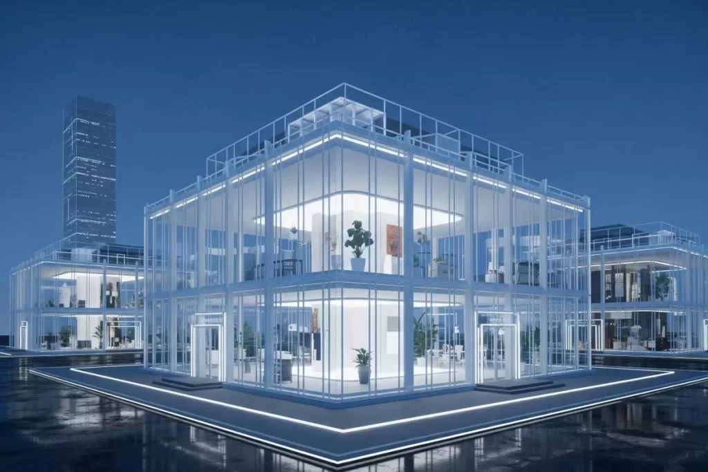
    A modern glass building rendered in sleek geometric lines, bathed in luminous reflections, representing NFT architecture in the Philippine real estate context, showcasing transparent façades and bold contemporary forms in a digital conceptual environment.
    NFT architecture heralds a frontier where creative visions transcend the limitations of the physical realm. Architects, liberated from regulatory and logistical constraints, can explore new paradigms in form, materiality, and spatial narrative. The digital marketplace now offers a stage where architectural expression thrives as collectible art, engaging both investors and connoisseurs. This emergence redefines the architect’s role, restoring its identity as an artist in the purest sense.

    The opportunity reminds us that architecture’s core identity is an art expression and reintroduces the architect’s role as an artist. The first architects in the world, after all, were renowned artists. NFT architecture can potentially provide architects and design firms with alternative sources of revenue by marketing their work on online platforms as digital art.

    The Unbuilt Environment: Virtual Real Estate

    With NFT Architecture as a real possibility, the next question is the implications on real estate. NFTs can also represent metaverses, virtual worlds, and virtual real estate. In the NFT space, SuperWorld, and Somnium Space are platforms where you can buy, sell, and collect virtual parcels of land. Other platforms, such as Decentraland, The Sandbox, and Cryptovoxels, allow users to purchase land, build stores or art galleries, and communicate with self-created avatars, which provide more interactive and immersive experiences. These platforms sell $1.5 to 2.8 million worth of virtual land in monthly transactions. The active users in these metaverses are a potential market for NFT Architectural work, hiring architects to design a building in their virtual land and engage in digital architecture projects. Virtual worlds and the NFT architecture provide the framework for such scenarios.

    NFT Architecture is a novel technology that can create meaningful applications in the construction industry. The benefits of NFT are numerous, but one of the most important benefits is its ability to provide a more immersive experience for architects, designers, builders, and users. 

    Architects and developers have enjoyed the forming of physical environments over centuries. But this generation may face a new and exciting realm of virtual real estate: NFT Architecture and the Unbuilt Environment.

  • How To Spot An Authentic Land Title In The Philippines

    How To Spot An Authentic Land Title In The Philippines

    Ensuring that the land title is authentic when investing in real estate properties in the Philippines could be pretty tricky. The country is a growing market for domestic and foreign real estate developers. And many illicit operators are exploiting this open demand. Several property alternatives are available, ranging from urban lands to abandoned development sites to large farmland plots. While purchasing a real estate property may seem like a simple procedure, consider these indispensable factors when making such a significant investment.

    Ready to get your defenses up? Here is everything you need to know about land titles and how to conduct due diligence before sealing the deal:

    What To Expect From A Land Title From The Transfer Certificate Of Title

    After executing the Deed of Absolute Sale or Deed of Sale, the Transfer Certificate of Title (TCT) is a property title assigned to the new owner with a parcel of land either with or without a built physical structure. It contains details on the land’s registration number, owner name, and geophysical conditions. Apart from land ownership, it also awards “air rights” to the owner, which allows him to develop the “air space” above his property.

    However, another essential part of the TCT you should watch is its transfer history. Typically, this includes a directory of legally canceled Transfer Certificate of Titles due to the cycle of ownership.

    Pre – TCT: Verify The Seller’s Identity

    Anyone can pose and act as a landowner. Before initiating any real estate transaction (or any transaction, for that matter), checking the person’s identity is the first step in checking its authenticity. Potential buyers must request a copy of the seller’s legitimate identification to verify that the same individual is the land’s lawful owner. For that matter, buyers must only deal with the land’s actual owner, not through an agent or an unregistered owner.

    Buyers may encounter difficulties dealing with sellers whose parents are the legal owners. Heirs may have conflicting stands on how to utilize the property. Mainly whether they should sell the property or not. If the sellers wish to sell the property, they must first file a petition in court before engaging in negotiations with possible bidders.

    If the landowner is a corporation, ensure that the corporate entity is registered correctly. The secretary’s certificate documentation should accompany the legal representative appointed by a board decision.

    Continue to check the land title’s authenticity – physically, internally, and legally – after the buyer’s legitimacy has been confirmed.

    A close-up image of a person presenting a government-issued identification card beside a registered land title document on a desk, symbolizing land title verification in Philippine real estate transactions.
    In the intricate framework of Philippine real estate, the validation of ownership stands as the primary safeguard for every transaction. The prudent buyer examines the legitimacy of the seller’s identity before engaging in any contractual discourse. This process ensures that negotiations occur with the rightful landowner, not an unauthorized intermediary. The measure preserves the integrity of the agreement and prevents disputes rooted in contested claims.

    Mid – TCT: The Physical Document Of The Land Title And Contents

    One of the fastest ways to detect fake land titles is by examining the physical document itself. Remember that the Banko Sentral ng Pilipinas is the only duly-authorized supplier for papers to be used in original land titles in the country. The land title document makes them physically different from the commercially-issued form. Below are six elements to watch out for:

    Texture: Must be similar to that of a bank check

    Watermark: A faint watermark with the letters “LRA” must be visible.

    Paper Color: Light yellow for old titles; pale straw for e-titles; all tiny dots and fibers must be noticeable

    Under UV light: The duplicate threads must slightly shine when exposed to UV light.

    After establishing the land title document’s physical legitimacy, the next step is to check the TCT’s legal “cleanliness,” which assures investors that it passed through the correct legal procedures. To do so, review the following checklist to see whether your land title meets the requirements:

    For Original Certificate of Title (OCT): “Judicial Form No. 108-D” must be indicated at the top of the land title.

    For Transfer Certificate of Title (TCT): “Judicial Form No. 109-D” must be indicated at the top of the land title.

    Serial Number: Its label (SN No.) should be in red, while the owner’s duplicate should have black digits.

    Page Number: Its last two digits located on the upper right-hand side should correspond to the last two digits of the TCT number.

    Border: The red or blue border appearing on the land title document should be slightly embossed and not flatly printed.

    Seal: Should be located in the lower left-hand side; dark red, and does not blot when subjected to water.

    Title History: Track the TCT’s mother title, derivative titles, and other relevant documents to check if the source is genuine.

    Primary Entry Book: Look for a related transaction to confirm the issuance of the title based on a duly registered document.

    Enumeration or Log Book: Determine who was appointed to prepare the title on a certain day, as well as the serial number on the judicial form utilized.

    Releasing Book: Confirm if the Registry of Deeds released a title of such number on the same date.

    Signatories:

    • Registry of Deeds: Check if the person signing the land title is the same as the person registered with the Register of Deeds upon the issuance of the title.
    • Judicial OCT and TCT: Two signatures must be present in the OCT – the Administrator and Registrar; for TCTs, only the Registrar’s signature must be present.
    • Administrative OCT and TCT: Two signatures must show – one from a PENRO or CENRO officer and another from the Registrar.

    For e-Titles: All entries must be computer encoded and printed.

    For Destroyed Titles: Destroyed titles must undergo reconstitution; OCTs should have the initials “RO” before the title number; for TCT’s, the initials “RT” should be provided before the title number.

    Liens and Encumbrances: The owner of a piece of land with a Lien may use it to satisfy a debt to another party. In this case, the owner shall pertain to the seller himself. Annotations for liens and encumbrances such as adverse claims and mortgages, among others, are located on the back page of the title. The sections of these pages should be empty in assuring buyers of a “clean” land title.

    Paid Real Estate Taxes: The seller should settle this obligation. The buyer may confirm with the Assessor’s Office of the complete payment. Both buyer and seller should work out arrears and back taxes reflecting the difference in the property price negotiations. Remember to have a notarized document for the agreement on the payment of back taxes.

    Double Check the Technical Description: If possible, ask permission from the seller to have the lot surveyed by a Geodetic Engineer. The physical shape and size indicated in the land title can be verified by a professional. In cases where the actual lot area is less than the declared size, you may request a proportional price reduction.

    Post – TCT: Check With The Authorities

    Even if the land title in question has all of the advantages mentioned, this does not guarantee its legitimacy. Completing evaluating an original land title requires a few more steps. Visits to any five offices may further validate the property’s existence and legality.

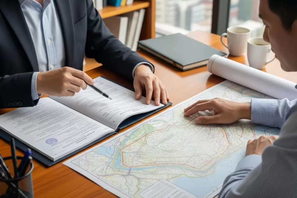
    A person seated at a desk reviews a stack of official documents, including a land title and technical property map, alongside open folders and a pen, representing multi-agency land title verification in Philippine real estate transactions.
    The path to acquiring property in the Philippines demands more than the possession of an original land title. Authenticity emerges from a deliberate sequence of verifications across designated government institutions. Each visit affirms a distinct layer of legal and technical integrity, ensuring the title reflects the true nature of the property. This method transforms the acquisition into a measured act of due diligence rather than a mere exchange of documents.

    Registry of Deeds: Personally visit the office of your locality’s Registry of Deeds to confirm the authenticity of your TCT

    Municipal or City Assessor’s & Treasurer’s Offices: Visit your locality’s Assessor’s Office to double-check the accuracy of your TCT’s technical description as well as the vicinity map needed for either DAR or BIR clearance. A visit to the Treasurer’s Offices may verify the property’s financial records about tax payments, arrears, and delinquencies.

    Land Registration Authority (LRA): LRA serves as the repository for all titles in the Philippines. Hence, a visit to their office could help trace the property’s history.

    Department of Human Settlements and Urban Development (DHSUD): For buyers looking for subdivisions or condominium properties, ensure that the seller has the necessary approvals and permits from DHSUD before selling or advertising.

    National Housing Authority (NHA), Department of Environment and Natural Resources (DENR), Bases Conversion and Development Authority (BCDA): These offices should cater to specific land titles and applications such as housing programs, public land patents, and conversion of military bases to civilian properties, respectively.

    Governing Laws Against Fraudulent Land Titles

    Section IV of the Revised Penal Code of the Philippines covers the law against the falsification of legislative, public, commercial, and private documents and wireless, telegraph, and telephone messages. Penalties of up to Php 5,000 and six-month imprisonment await offenders as stated under articles 171 and 172.

    Amendments to the articles above are also on the rise. House Bill No. 6357 seeks life imprisonment upon offenders. Furthermore, the Land Registration Authority also initiated an inter-agency task force named Task Force Titulong Malinis (TFTM). The task force works with the National Bureau of Investigation (NBI), Office of the Solicitor General, and the Department of Justice (DOJ), among others. This agency is in charge of investigating, prosecuting, and canceling fake land titles and their corresponding syndicates.

    Apart from TFTM, the agency also launched the Voluntary Title Standardization Program. The program allows property owners to convert manually-issued titles to electronic titles or e-Titles. With e-Titles, property owners can protect their titles from tampering, theft, loss, and damage. They also come with unique barcodes and watermarks.

    Conducting Thorough Land Title Due Diligence

    Being mindful of the qualities of an authentic land title is an excellent way to dodge potential fraudulent scenarios in the real estate industry. In conclusion, remembering the old saying caveat emptor of “buyer beware” is a must when looking for potential properties.

  • How To Apply For Certificate Of Registration In The Philippines

    How To Apply For Certificate Of Registration In The Philippines

    As property developers, you are responsible for securing the Certificate of Registration (CR) and License to Sell (LS) Subdivision/Condominium Projects and Other Real Estate Projects. Accomplishing these requirements will eventually provide a smooth and transparent transaction for buyers looking for potential developments. Part of that responsibility involves acquiring all related certifications and licenses that will allow you to serve the market with the utmost confidence and professionalism.

    Presidential Decree 957 (PD 957), also known as “The Condominium and Subdivision Buyer’s Protective Decree,” advises real estate buyers to look for three essential requirements before purchasing any potential property. These are the Certificate of Registration, the License to Sell, a Broker/Agent’s Certificate of Registration, and the Department of Human Settlements and Urban Development (DHSUD) ID Cards.

    This article will explain the essential prerequisites for obtaining a Certificate of Registration, what they are, how they function, and what you need to prepare.

    What Is A Certificate of Registration?

    The Certificate of Registration (CR) is a formal certificate given by the Department of Human Settlements and Urban Development (DHSUD) or formerly known as the Housing and Land Use Regulatory Board (HLURB), that certifies the viability of the project as well as the capability of the developer in implementing the project. Hence, it practically revolves around a simultaneous screening process of the real estate project and the proponent-developer.

    What Requirements Should You Prepare?

    Developers planning to apply for a Certificate of Registration are legally required to have a minimum of 10 documents at hand before processing. Although Rule IV – Section 7 of PD 957 specifies a whole list, the following is a less overwhelming list of the CR requirements classified by the nature of the document:

    Maps and Drawings

    • Certified True Copy of either the Transfer Certificate of Title (TCT) or Original Certificate of Title (OCT) with a “CERTIFIED TRUE COPY” stamp by the corresponding Register of Deeds (RD) bearing its seal or security marker
    • For projects covering over 20 individual titles without the requirements mentioned earlier, shall require the following:
      • Photocopy of all TCTs
    • Certification from the concerned RD stamped with a seal or security mark, showing the following information:
      • TCT or OCT numbers
      • Number of TCT or OCT where the title is derived
      • Lot and block numbers, PSD/PSU/PCS numbers, etc.
      • Name of the registered owner(s) and, if any, their sharing
      • Area covered by each land title
      • If any, statement of all uncancelled encumbrances and liens.
    • Electrical drawings and specifications are signed and sealed by a licensed electrical engineer and duly approved by the local franchise holder.
    • Master Deeds with Declaration of Registration and Declaration of Restrictions annotated correctly in the title(s) of the property.
    • Certified True Copy of the mentioned title(s) from the Register of Deeds

    Business and Financial Documents

    • Certified copy of the original, duly-audited balance sheet signed and issued by an official authorized by the applicant.
    • Articles of Information (or of Partnership or Association) authorizing the applicant to engage in real estate trade, particularly in the selling and development of both lands and units
    • Advertisement, brochure, circular, communication, or any prospectus used for public offering and circulation of the said project – duly approved by the Board
    • A sample copy of Contract to Sell to be used for the public offering of lots, units, or both

    Authorizations and Affidavits

    • Sworn Registration Statement with either:
      • HLURB Form 001 for Corporation
      • HLURB Form 003 for Single Proprietorship
    • In case of amendments bound to affect the Contract to Sell, Pro-forma affidavit signifying willingness to change the project name
    • Certified True Copy of Environmental Compliance Certificate (ECC) or Certificate of Non-coverage (CNC), whichever is applicable from the DENR or more known as the Department of Environment and Natural Resources 
    • Zoning Certificate from the HLURB Regional Office
    • Certified True Copy of DAR Conversion Order, except in properties already classified as residential, commercial, industrial, or other similar occupancies
    • Authorization to operate a deep well and water resistivity test from the National Water Resources Board (NWRB)
    • Water potability test results from concerned agencies such as Maynilad
    • Building Permit
    • In case of TCT’s issued more than one month before the application, an affidavit of the owner certifying that the property is free from liens and encumbrances
    • If the applicant is not the owner, a deed from the registered owner showing the apparent authority of the applicant to the property will be the one to sign and receive documents and other similar proof of power.
    • The following affidavits are required if there is a mortgage to the project or a portion of the project:
      • Affidavit of undertaking to submit the title
      • Certification from the mortgagee regarding the outstanding balance of loan and amortization schedule
      • Mortgage of contract
      • Affidavit of the undertaking of the mortgagor
    • For businesses deviating from their intended purpose, authorization from the Securities and Exchange Commission (SEC) and the appropriate government agency to engage in the development and selling of the project

    How Does The Certificate Of Registration Application Process Work?

    Although relatively different, the application process of the Certificate of Registration (CR) and License to Sell (LS) are the same. Below is s step-by-step workflow of the application process:

    Filing: One-day Processing Time

    • Applicant files application with all necessary documents
    • A Records Officer (RO) from the Records Section (RS) checks the completeness of the documents. The application will be forwarded to the Regional Director’s Office once complete.
    • A Records Officer from the Regional Director’s Office (RDO) receives, logs, and indorses the documents to the Technical Services Group (TSG)
    • The Head of the TSG receives and assigns documents to the processor for evaluation.

    Evaluation and Pre-publishing: One- to Three-day Processing Time

    • The processor evaluates the compliance of the application based on the requirements.
    • If the application deviated from standards and guidelines, the processor issues a Notice in Deficiency in Requirements
    • Processor fills up the Pro-forma Notice to Publish

    TSG Evaluation: One-day Processing Time

    • Head of the TSG evaluations documents and initials
    • The Technical Services Group will then forward the application papers to the Regional Director’s Office (RDO)

    Back to the Records Section: Two- to Three-day Processing Time

    • Records Officer (RO) from the Regional Director’s Office (RDO) forwards the documents to the Records Section (RS)

    Mailing of Notice to Publish: Two- to Three-Week Processing Time

    • Records Officer (RO) from the Regional Director’s Office (RDO) mails the Notice to Publish to the applicant

    Public and Pre-inspection: Seventeen-day Processing Time

    • The applicant receives and publishes Notice to Publish
    • The applicant submits Affidavit of Publication
    • Applicant coordinates with the inspector or processor to schedule a site inspection

    Registration and Inspection: One- to Two-day Processing Time

    • The processor receives an Affidavit of Publication.
    • After two consecutive weeks from the last day of publication, the processor will consider the project as registered unless clearance from legal and monitoring groups requires compliance to orders issued by the Office.
    • Inspector conducts site inspection, determines the extent of the development, and computes its performance bond and processing fee.

    Performance Bond and Fee: One- to Two-day Processing Time

    • Inspector accomplishes the Pro-forma of letter or advice on performance bond and fee
    • Inspector evaluates and initials

    TSG Evaluation: One- to Two-day Processing Time

    • The Head of the TSG evaluates documents and signs
    • A Records Officer from the Regional Director’s Office forwards the documents to the Records Section

    Order of Payment: One-day Processing Time

    • Applicant posts a performance bond and submits the documents certifying the performance bond or guarantee from the Financing Institution.
    • A Records Officer from the Regional Director’s Office receives the documents and prepares an Order of Payment (OP)
    • Applicant pays the corresponding processing fee.
    • The cashier receives the payment and prepares an Official Receipt (OR)

    Performance Bond Evaluation and CR Awarding: Three- to Four-day Processing Time

    • Processor evaluates the acceptability of the performance bond
    • Processor proceeds to prepare the Certificate of Registration and Executive Brief
    • Head of the TTSG reviews and signs the mentioned documents
    • A Records Officer from the Regional Director’s Office logs out the papers and transmits them to the Records Section
    • A records officer from the Records Section releases the Certificate of Registration to the applicant

    The Purpose Of the Certificate of Registration

    As you may have observed, the application procedure for the Certificate of Registration is where the project and all parties involved undergo due diligence. Given its mandatory nature under the Philippine law, having a clear picture of what this certification entails is one of the primary steps in securing a smooth-sailing real estate endeavor.

  • Master Planning For Making Cities Great Again

    Master Planning For Making Cities Great Again

    Master planning is a process that has been around for a long time. It is the process of creating and carrying out a plan for the physical development of a large area. Establishing a solid connection between a community’s grand vision and its initiatives may go a long way toward laying the groundwork for long-term growth, and it is the master planner’s responsibility to initiate the transformation.

    Master Planning As An Encompassing Term

    A master plan is a strategic document for the development of an area. It is a long-term vision for the future development of a place, including the goals and objectives of the community. A master plan typically includes land-use policies, zoning regulations, demographic projections, and budgetary forecasts. It may also have environmental protection, social services, public works projects, and public policies.

    In general terms, a master plan refers to any planning document and spatial layout used for the configuration of land use and development. As cited, a master plan can range from visual representations of small-scale complexes to 10-year implementation schemes of region-wide projects.

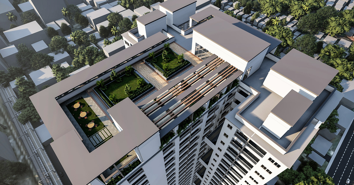
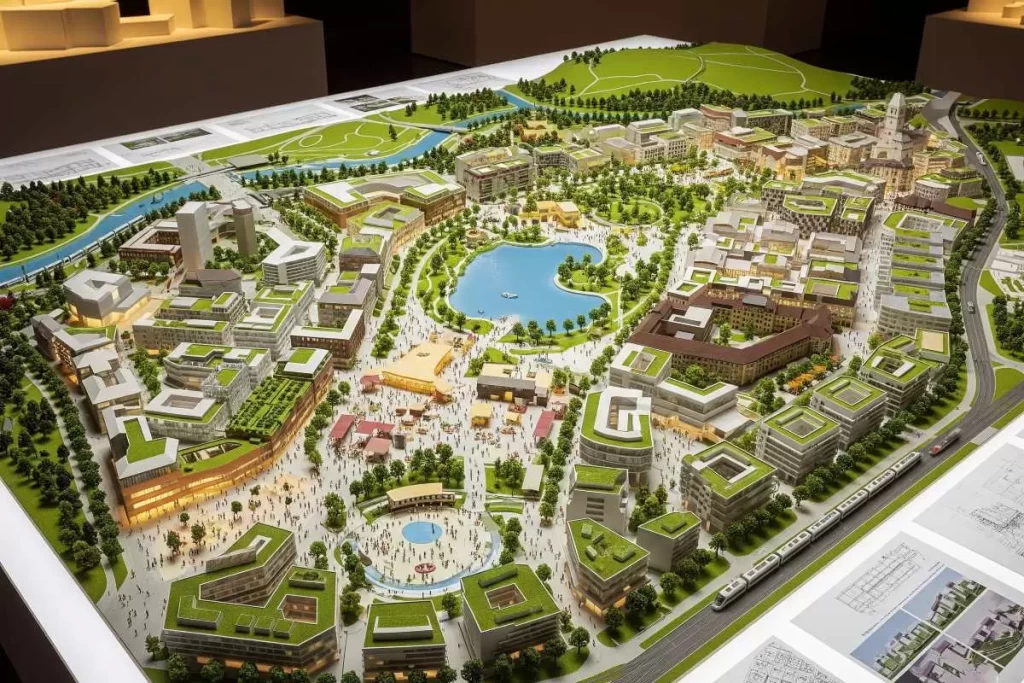
    An aerial architectural rendering of a comprehensive master planning design showing interconnected buildings, landscaped public spaces, transportation routes, and zoning layouts, illustrating the strategic spatial organization and long-term development vision for a modern Philippine community.
    Master planning serves as the compass for shaping a place into a coherent and thriving environment. It unites spatial design, community aspirations, and economic foresight into a single vision for sustainable growth. This strategic framework aligns architecture, infrastructure, and policy into a long-range guide for land use and development. It is the foundation upon which purposeful and enduring spaces are realized.

    Whatever the range may be, the essence of a master planning relies heavily on creating a seamless connection between its buildings, social settings, and surrounding vicinity, all for its future growth and development. Due to its vast scope, the master planning process calls for immense collaborative work between the authorities and their constituents manifested through public input and the analysis of current results.

    Master Planning Development

    Creating master plans outlines the way ahead for each individual. These plans can range from long-term to short-term and may involve various aspects of life such as career, financial, relationships, family, or lifestyle. There is no set rule in creating one; however, integrating one’s planning style and approach molded by ability, knowledge, and experience makes a specific master planning process unique from the other.

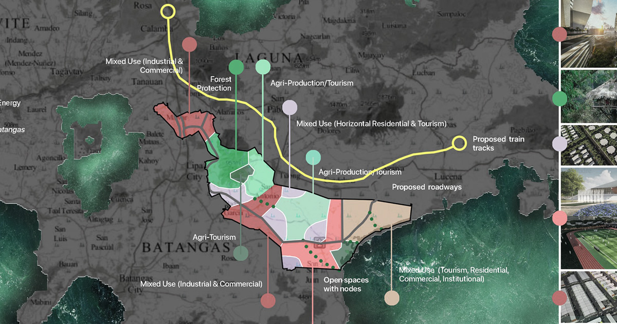
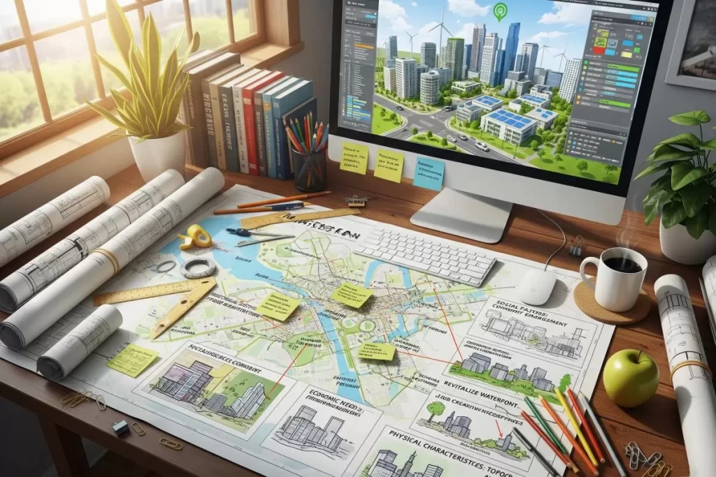
    A detailed urban development plan illustrating the stages of master planning, featuring labeled zones for residential, commercial, and civic spaces, interconnected road networks, green corridors, and public plazas, designed to demonstrate the strategic relationship between site analysis, design development, and community vision in a Philippine urban context.
    Master planning defines the structured pathway toward shaping environments that respond to both present conditions and future aspirations. It begins with the careful study of a site’s physical attributes, social fabric, and economic realities, advancing toward integrated analyses that guide purposeful design. Each stage transforms knowledge into spatial strategies that reflect the vision of the community and the practicalities of the location. Through this process, the built environment becomes a deliberate synthesis of function, identity, and cultural resonance.

    While there are no hard and fast rules, the following are the fundamental steps for building a master plan that a planner should keep in mind while establishing one:

    Step 1: Site Appraisal

    Effective master planning requires a thorough grasp of the place. Generally, many evaluations will be necessary to examine the site’s present and future circumstances thoroughly. These components include but may not be limited to physical, social, and economic considerations.

    Physical Characteristics

    Creating a good site design depends on understanding the purpose of the location and creating a framework for that use. Understanding the site context, visual identity, and how it communicates to the rest of the vicinity makes the physical aspect of the site appraisal. Climate impacts a region’s physical environment and proximity to water, power supply, and food sources. Urban planners must also take into consideration the current usage of the land.

    Social Factors

    Establishing the opinions and aspirations of the community can result in an effective master planning exercise wherein the people are at the heart of the process. In most circumstances, assessing the property’s physical or environmental qualities reflects those social and financial conditions.

    Economic Needs

    Planners must understand whether economic factors support or impede a city’s progress. The amount and kind of industries in an area will influence its layout. The socioeconomic position of residents, regional employment, and economic trends may all aid planners in developing an urban area. In other words, a metropolis like Manila, which has limited land resources, would have different requirements than a more flourishing district such as Taguig.

    Step 2: Site Analysis

    After conducting a comprehensive study, the next step is to compile all the information and establish all relevant policies that consider the mounting data. The land property needs extensive analysis to be able to make informed decisions. Areas need assessment for the soil type, slope, quantity of trees, and amount of sunlight to develop a sustainable living plan.

    While policies may depend per locality, below are essential documents to look for:

    • Local and National Policies and Guidelines
    • Supplementary Planning Guides
    • Urban Design Frameworks
    • Site-specific & Development Vision Opportunities

    The public collaboration established during site appraisal should also continue during the analysis phase. For localities with master plans previously produced yet never implemented, it is vital to know why it was not commenced and ensure that all problems are understood and fixed early on. 

    Step 3: Developing the Design

    The design conceptualization process should begin as soon as the results of the integrated site investigation have been finalized and verified. It is essential to examine three critical applications: buildings, movements, and places when designing such notions. The design activity must consider various approaches to translating the community’s objectives into physical projects. The most sensible outcome will help narrow down the different design options resulting from several planning possibilities.

    Step 4: Testing the Design Concepts and Finalizing the Master Planning Presentation

    With the master plan available options in hand, the next stage evaluates each opportunity to determine which best reflects the community’s vision and impact. Furthermore, it is critical to exhibit each design in three dimensions with supporting data to provide a complete visual representation of the site and its design idea. Master planning is a collaborative process that requires input from planners, designers, implementors, the community, stakeholders, and city leaders. The organization and composition of the master planning team are also examined during testing, as are the mechanics of master plan development and significant implementation concerns.

    Master Planning For Better Cities

    Master plans are the most successful when they represent a vision that unifies and addresses the concerns of different interest groups. A master plan can be a single document, a series of documents, or a collection of papers created to outline a proposal for how a community’s future development might unfold. Clever and creative thinking can help regain that sense of place by recognizing the delicate nature of the planning story and the need for buildings and open areas sympathetic to the existing surroundings.

  • The Horizontal Condominium Strategy For Foreign Investments

    The Horizontal Condominium Strategy For Foreign Investments

    Horizontal condominium projects are becoming an alternative method of development for sure developers. Here’s why. The Philippines’ real estate market has accelerated in recent years, owing to a consumption-driven market, a youthful populace, and a collectively aggressive economy. With the industry’s present and future success, it’s unsurprising that an increasing number of real estate developers are venturing into various condominium developments. Sometimes condominium developments are depicted as high-rise structures nestled away in active commercial areas outfitted with enhanced security and upscale facilities. However, another type of condominium development combines the communal luxuries of vertical condominiums while mimicking the planned neighborhood units of your typical subdivision.

    What Is A Horizontal Condominium?

    A condominium, as defined by Republic Act No. 4726, or “The Condominium Act,” is composed of “divided” and “undivided” interests. Separated or distinct interests may refer to the structure itself, whether residential, commercial, or industrial construction divided and sold into different sections. Undivided interests include the asset itself and shared facilities such as playgrounds, gyms, and function rooms.

    Horizontal condominiums work similarly to vertical condominiums in concept since the term “condominium” relates to ownerships of divided interests. In contrast to their high-rise counterparts, their development type resemble typical suburban houses or villa resorts.

    Horizontal or detached condos are clusters of residences on land assets that provide tenants with a variety of recreational and security amenities. Each home has a floor size of between 100 and 300 square meters and is two floors tall, with room for one or more automobiles in the garage. It may accommodate up to five bedrooms, each with an en-suite bathroom and high-end comforts.

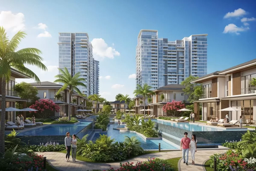
    A resort-style horizontal condominium community in the Philippines featuring clusters of two-story detached homes with landscaped gardens, private garages, and shared amenities such as a swimming pool, clubhouse, and fitness facilities, illustrating the masterfully planned integration of private residences and communal spaces.
    A horizontal condominium presents a residential typology that merges the privacy of a detached dwelling with the benefits of shared amenities. It offers residents the comfort of expansive interiors while preserving a sense of community within a secured environment. The spatial arrangement fosters both individual retreat and collective interaction through well-planned common spaces. This form of development reflects an evolution in urban living that balances exclusivity and accessibility.

    Real Estate For The Foreign Market

    Permission to own condominium units is granted to foreigners as long as the percentage of foreigners owning condo units in a development project does not exceed 40% of Filipino-owned condominium corporation shares.

    The majority of condominium units’ location is in high-rise structures. However, other property developments in the Philippines are offering single-detached homes or private villas with condominium ownership. Although the buildings are co-owned, the developers retain ownership of the property.

    Foreign nationals or corporations may also own a condominium or townhouse in the Philippines. They may form a Philippine corporation to purchase residential real estate and land and commercial real estate and land.

    What Caused The Development Of Horizontal Condominium Projects?

    The worldwide crisis of 2008-2009 necessitated the development of new housing plans that provided more economic flexibility for both developers and prospective buyers. This resulted in a project model resembling a typical house that sells as a fee-simple condominium.

    While a horizontal or detached condominium does not have its legal lot, it is also separate from another structure. This arrangement enables developers to squeeze homes with 10-meter by 20-meter footprints between 1.5-meter gaps, with access roads maintained and administered privately by the homeowners’ organization. The business offer enabled first-time homeowners to purchase a three-bedroom, two-bathroom house for a lot less than an identical model inside a regular subdivision.

    Financially speaking, detached condominiums resonated better with the recession than the conventional vertically attached condominium. Since proposed vertical condominiums require 60% of their units to be pre-sold before actual construction with a 20% down payment for each buyer, this business approach seems unfit for the then-existing crisis.

    On the other hand, developers may build detached condominiums separately. They are breaking ground only on sold units. In hindsight, this focus on building footprint and infrastructure packed at greater densities resulted in reduced construction and economic risks for purchasers and developers. The detached or horizontal condominium was a modest answer to the world’s housing crisis about a decade ago.

    The Difference Between Attached and Detached Homes

    Two main elements distinguish detached condominiums to attached (townhouse) and detached (single-family) homes. Those are ownership and maintenance responsibilities.

    In detached condominiums, residents only own the interiors of their units plus one share of all the complex, including the driveways, pool, roofs, siding, and the likes. A homeowners’ association is responsible for maintaining the common areas, requiring owners to pay corresponding monthly dues. The same organization is also handling complaints, planning future expenses, and limiting pets, vehicles, and outdoor furniture allowed on-site.

    A detached condominium and an attached home (townhouse) have a homeowners’ association, but the attached home owns the whole structure, including the roof and the ground below it.

    While a homeowners’ association still prevails over these properties, their sole purpose in neighborhoods is to enforce rules, not to maintain the overall physique of the community.

    An elegant horizontal condominium development in the Philippines showcasing detached two-story homes with landscaped gardens, a resort-style swimming pool, paved walkways, and communal recreational areas, highlighting the integration of private residences with shared amenities.
    A horizontal condominium redefines residential living by uniting private interiors with collectively managed spaces. Ownership extends beyond the home’s walls into a shared stake in amenities, landscapes, and structural elements that shape the community’s character. This model fosters harmony between individuality and shared responsibility through central governance and curated upkeep. The environment it creates merges the intimacy of a personal residence with the refinement of a well-maintained collective domain.

    Benefits Of Horizontal Condominium Units

    Without the duties of the land asset, detached or horizontal condominium units are by default more affordable compared to other types of housing developments.

    Additionally, despite the notion of their affordability, these developments still offer a wide variety of similar leisure and luxury amenities present in vertical condominiums such as swimming pools, party rooms, wellness centers, gyms, gardens, parks, and more.

    Detached condominiums are also a wise option for tenants who want to live in a safe place since these residential projects planned for a gated community offer reliable protection.

    The Disadvantage of Owning A Horizontal Condominium Residence

    Like all condominium projects, the restrictions and rules of the condominium corporation govern all tenants. By far, the only noted disadvantage of detached condominiums has to comply with the same laws followed by every other resident inside the community. Although this may be uncomfortable for a few, the perks associated with these developments outweigh the negatives. 

    The Long Position Real Estate Strategy

    The real estate market has changed a lot in the past few decades. Horizontal condominiums have become more prevalent because of these changing trends. With all the benefits of retaining land ownership and opening to foreign currency investments, numerous future property developers are sure to invest in horizontal condominium constructions to increase their company profits.

  • An Introduction To Thymotecture

    An Introduction To Thymotecture

    Thought I’d share a studio project back in 2011 which revolves around the idea of creating empathic panels to be used as surface materials. The word empathic here loosely describes the ability to sense and react to some kind of stimuli whether environmental or biological. I imagine that there would be these panels that can be developed to gather, centralize, and analyze data as well as provide a parametric feedback mechanism that actually changes the form of the panel in order to adapt to its directives. It would seem like we would no longer live inside inanimate structures but interact with active appliances that envelope and protect our welfare. Maybe the concept is no longer that fresh now but back then when I was still tinkering with this concept, there were only a handful of resources then. Most of which merely focus on mechanical control systems. Thymotecture is about adding some sort of technological spirit to buildings. I’m talking about baselines, monitoring and evaluating real-time performances, forms that actually validate themselves, and best of all, operates like the internet where all panels anywhere in the world are connected and can share data and applications. I have an ongoing paper on this actually but thought it is better to occasionally upload portions of the study for discussions.

    An Introduction To Thymotecture

    Green buildings and sustainable designs are major movements in the design, development, and construction industry today. Climate responsive designs are becoming an integral part of the environmental framework practices all around the world. With the advent of the communications and information era, the building industry has even started adopting fresh technologies and techniques that would enhance collaborations on virtual building environment modeling in order to address issues on sustainability, resource management, energy analysis, and construction responsibilities. Architects and allied professionals in the industry are working together in the hope of reducing the impact on the environment and human health.

    Are Policies Enough?

    Diversified policies are being introduced as well to help establish standards in measuring new construction. A green building that adheres to proposed design and construction practices that significantly reduce or eliminate the negative impact of building on the environment and occupants are being classified under rating systems and certifications. A point-based rating system is a consolidated approach to estimations of particular credits to best practices in various disciplines of architecture, engineering, interior design, landscape architecture, and construction.

    Given the complexity involved in solving barriers to a more sensitive and responsible future building construction and operations, how do we further determine if a development used with proposed design and construction practices did significantly reduce or eliminate the negative impact of buildings on the environment and occupants? More so, how do we evaluate or monitor an entire collection of buildings’ relationships to one another and the urban ecosystem in which they support in accordance with an ideal global environmental setting? How do we bridge this gap between technology in the early design stages to the final product delivery?

    We need a system that could deliver the more intrinsic prognosis of our planet’s ailments in places where human intervention is at its most alarming density. We can only take steps toward administering the corresponding cure if we could only deploy feedback mechanisms to know exactly what we are up against.

    The future of climate-responsive buildings is the formation of techno-organic surfaces capable of intelligent sensory, communication, and reactive systems.

    A digital rendering of a modular design concept for climate-responsive building panels showcasing geometric patterns, integrated sensor nodes, and kinetic components, representing thymotecture in sustainable architectural systems.
    The paradigm of thymotecture advances through modular systems capable of responding to environmental flux. These building panels serve not only as structural or aesthetic solutions but as intelligent devices with embedded cognition. Designed to interface with data ecosystems, they adjust behavior in real time, bridging material permanence with climatic variability. In this orchestration, architecture begins to breathe, think, and act.

    Thymotecture is an accumulation of spirited technologies enabling developments in architecture for empathic skyscrapers of tomorrow, capable of monitoring and measuring anthropogenic and environmental interferences using techno-organic surface appliances as building materials. Similar to the introduction of steel as a breakthrough material to height barriers, computational technology at the birth of social industrialization attract the use of techno-organic building innovations and techniques that would promote a new movement in architecture.

    Thymotecture Begins At Surface Sensing

    Building surface elements could be compacted with computational processors and graced with input/output interfaces. These elements such as partitions, finishes, openings, or envelopes in turn are connected by a global network that would have the ability to gather data and respond to applications much similar to portable devices with internet capabilities. Building parts can then start to act as appliances communicating with other building parts in as much as one whole building interacting with its surrounding site or even with an entire city. Hence, the intention is to induce spiritedness in architecture as with Arthur Koestler’s The Ghost in the Machine.

    This network of building part appliances becomes a building broadcasting system delivering empirical prognosis of the planet’s ailments in places where human intervention is at its most alarming density. By deploying feedback mechanisms and knowing exactly what we are up against, we can then take corresponding steps toward the more sensible climate-responsive design solutions.

    A conceptual diagram illustrating interconnected building components embedded with digital processors and sensors, representing thymotecture as a responsive architectural system that communicates environmental data across a global network.
    As architecture embraces computational intelligence, building envelopes begin to function as sentient surfaces—gathering data, exchanging signals, and contributing to broader ecological feedback loops. These assemblies no longer serve static roles but act as coordinated systems of input and output, capable of interfacing with their contexts. This evolution articulates an emergent architectural typology where materials, geometry, and embedded technology embody the spirit of thymotecture—a synthesis of matter and responsiveness. Through this, the built environment achieves a visceral, almost living, rapport with the world.

    The Role Of Multi-Sensors In New Building Designs

    Multi-sensor fusion and integration is a rapidly evolving research area in today’s multi-disciplinary fields of artificial intelligence and robotics, weapon systems, biomedical systems, signal processing, remote sensing, and transportation networks. Empirical computations from multi-sensors may be able to advance current tools in Building Information Modeling to Meta-Point Cloud Modeling with real-time prototyping, simulation, security, and feedback analysis in a complete cycle of design.

    Sensors, Controls, and Actuators

    As an act of representation, whether virtual or live, built-in actuators could also orchestrate as a whole to invoke the entire surface skin to perform morphological responses based on parametric computations gathered from both nearby and remote techno-organic datasets hence fostering new forms, new types of curves or shapes, or possibly elicit unimaginable surface configurations on its own. Meanwhile, an open-source trade of techno-organic innovations may be able to transform the manufacturing industry into a more socially motivated platform.

    The Building’s Artificial Intelligence In Thymotecture

    A formalized vernacular expression that would freshly engulf the concrete and glass landscape with techno-organic building materials sprouting from Thymotecture’s basic principle of sensing the truth around us and mankind’s monitored reaction to it. Hopefully, the relationship of interdependence we develop with these sensing surface appliances creates a positive attachment and involvement for the much more climate-informed future communities to evolve into.

  • Environmental Compliance Certificate Online Application

    Environmental Compliance Certificate Online Application

    While infrastructure and civic projects are generally considered to be the catalysts of a locality’s development, a common flip side among these endeavors is inevitable environmental risks. To promote environment-friendly practices among the business community, one of the strategies leveraged by the local government is the issuance of the Environmental Compliance Certificate.

    What Is An Environmental Compliance Certificate?

    An Environmental Compliance Certificate, commonly known as ECC, is a certification issued by the Department of Environment and Natural Resources – Environmental Management Bureau (DENR – EMB) after a positive review of the project’s application.

    Aside from serving as a certification, it also recognizes a project’s compliance with all the requirements of the Environmental Impact Statement System (EIS) and has pledged to implement its approved environmental management plan.

    However, project proponents granted permission by the ECC must still comply with specific measures and conditions before and during the operation of the project. In some cases, certain conditions are given during a project’s abandonment phase to lessen any potential environmental impacts.

    Construction workers at a building site examine an environmental compliance certificate document while surrounded by heavy machinery, illustrating the importance of DENR–EMB approval for projects in Philippine architecture and real estate.
    The Environmental Compliance Certificate stands as a formal recognition of a development’s accountability to ecological stewardship. It embodies the state’s assurance that the proposed undertaking aligns with established environmental standards. The certification affirms that the project’s operations will follow a defined plan of impact mitigation, resource management, and ecological protection. It establishes a foundation for sustainable growth that addresses both human aspirations and environmental imperatives.

    What Law Supports The Issuance Of The ECC?

    As mandated by Presidential Decree No. 1586 (Establishing an Environmental Impact Statement System including other Environmental Management-Related Measures) dated June 11, 1978, all individuals, partnerships, and corporations shall secure an Environmental Compliance Certificate first before undertaking or operating any declared environmentally-critical project or area.

    Who Shall Apply For Environmental Compliance Certificate?

    Although the law does not directly specify the types of projects requiring ECCs, they are indirectly classified with the following statement: when a project is required to submit an Environmental Impact Assessment (EIA) in the form of an Environmental Impact Statement (EIS), they likewise have to submit an Environmental Compliance Certificate.

    Which Projects Need An EIS, And Hence An ECC?

    Pursuant to Presidential Decree 1586 (Establishing an Environmental Impact Statement System Including Other Environmental Management Related Measures and for other purposes), EIS and ECC are required for Environmentally Critical Projects (ECP) and/or projects located in Environmentally Critical Areas (ECA).

    What Are Considered To Be Environmentally Critical Projects (ECPs)?

    Projects under the heavy industries, resource extractive industries, and infrastructure projects are considered to be ECPs, which are further specified below:

    Heavy Industries

    • Iron and steel mills
    • Non-ferrous metal industries
    • Petroleum and petrochemical industries such as oil and gas
    • Smelting plants

    Resource Extractive Industries

    • Development of dikes and fish ponds
    • Forestry projects
      • Extracting of mangrove products
      • Forest occupancy
      • Grazing
      • Introduction of exotic animals in both public and private forests
      • Logging
      • Major wood processing projects
    • Major quarrying and mining projects

    Infrastructure Projects

    • Bridges and roads
    • Dams
    • Power plants
    • Reclamation projects

    Construction, Development, and Operation of Golf Courses

    The DENR-EMB does not require the issue of ECCs for projects that pose no environmental threat. Rather than that, they are recommended to submit an application for a Certificate of Non-Coverage (CNC), which will indicate that the planned project is not included in the Environmental Impact Statement (EIS).

    A large open-pit mine with heavy machinery and trucks operating on terraced levels of the excavation site, bordered by a dense forest, illustrating the role of an environmental compliance certificate in regulating extractive industries in the Philippines.
    The classification of projects requiring an Environmental Compliance Certificate underscores the gravity of their potential ecological consequences. Heavy industries, extractive enterprises, and expansive infrastructures alter landscapes and resource systems in profound ways. By delineating these categories, the framework clarifies which undertakings must undergo rigorous environmental review. The process affirms that transformative developments proceed only with safeguards that reconcile industrial ambition with ecological responsibility.

    Which Areas Are Under Environmentally Critical Areas (ECAs)?

    Apart from being considered as Environmentally Critical Projects, projects requiring ECCs shall be located in any of the following areas considered as Environmentally Critical Areas:

    • National parks, sanctuaries, watersheds, and wildlife preserves
    • Potential tourist spots
    • Habitats of any threatened or endangered indigenous Philippine flora and fauna
    • Places of unique archaeological, historical, and scientific background
    • Hotspots of frequent and/or harsh natural calamities
    • Critically sloping areas
    • Prime agricultural lands
    • Water bodies and aquifers that are characterized by any of the following elements:
      • Tapped for domestic use
      • Within controlled and/or protected locations
      • Supporting wildlife and fishery purposes
    • Mangrove areas that are characterized by any of the following elements:
      • Possessing 50% and more live coralline cover
      • Nursery and spawning grounds for fishes
      • Acting as natural breakwater of coastlines
    A tropical Philippine wildlife habitat with dense forest vegetation, visible bird species, and a flowing water body illustrating the importance of an environmental compliance certificate in protecting critical areas of ecological and cultural significance.
    Projects that occupy or intersect with environmentally critical areas are subject to the stringent mandate of the Environmental Compliance Certificate. These landscapes hold irreplaceable ecological, cultural, and scientific value, demanding careful stewardship. The framework acknowledges their fragility and affirms that development in such spaces must proceed with heightened vigilance. The certificate therefore safeguards habitats, watersheds, and heritage sites from the unchecked pressures of construction and industry.

    Is Your Project Inside The ECA?

    There are two ways on how to determine whether a project is located inside an ECA or not.

    One, for socialized housing projects, the former Housing and Land Use Regulatory Board (HLURB), which has been replaced by a new agency called the Department of Human Settlements and Urban Development (DHSUD), is responsible for issuing clearances indicating whether a project is located within an ECA or not.

    Two, for projects that do not fall under the category of socialized housing, their governing Local Government Units (LGUs) are responsible for supplying a Geographic Information System (GIS) for Comprehensive Land Use Plans (CLUPs). While such maps may aid in the identification process, the EMB will ultimately decide whether these projects fall under the ECA or not.

    How To Accomplish The Environmental Compliance Certificate Online Application?

    For a more streamlined application process, all necessary forms and project descriptions may be filled up online by visiting the Environmental Compliance Certificate Online Application System. Upon completing the process, applicants may download the accomplished documents for printing and notarization.

    Those who are searching for a full description of the online application procedure can consult the ECC User Guide for assistance.

    What Are The Requirements Needed To Prepare For The Environmental Compliance Certificate Online Application?

    Although ECC applications may be completed online, applicants should prepare the following documents prior to the transaction:

    • Application fee of Php 5,055.00 payable at any LandBank branch using the OnCall Payment Slip
    • Scanned copies of the deposit transaction slip and duly-notarized IEE Checklist
    • Geo-tagged photos of the proposed project site
    • Maps of affected areas showing at least 1 kilometer from the project boundaries
    • Certification from the LGU proving the compatibility of the proposed project within the existing CLUP
    • Site Development Plan or Vicinity Map
    • The layout of the plant or project signed by registered professionals
    • If applicable, a schematic diagram of the wastewater treatment facility
    • If applicable, a schematic diagram of the air pollution control facility
    • An organizational chart of the persons-in-charge of environmental concerns
    • Proof of authority over the project site, such as land title, deed of absolute sale, lease contract, etc.
    • Project Environmental Monitoring and Audit Prioritization Scheme (PEMAPS)

    How To Follow Up On Your Environmental Compliance Certificate Online Application?

    Applicants may connect with the EMB Regional Office by email. It is essential to check your account periodically for changes or extra requirements necessary to complete the application. In certain instances, it is also prudent to contact the EMB Regional Office for the region in which the project is situated.

    Applications are anticipated to be completed within 20 working days after receipt and acceptance of the required documentation, for which Certified True Copies may be acquired from the relevant EMB Regional Offices.

    Do ECCs Have An Expiration Date?

    ECP proponents granted the issuance of ECC shall implement the proposed project within five years upon approval of the ECC. Whereas, projects located in ECAs awarded with the same certificate shall implement the project within two years. Failure of implementation on the specified time frame nullifies the Environmental Compliance Certificate, which implies a re-application of the same document by the project proponents.

    Protecting The Nation’s Natural Resources

    In retrospect, the ECC is a document that authorizes a project to advance to the further phases of planning and execution, after obtaining clearance from the appropriate governmental authorities and Local Government Units (LGUs). By adhering to the ECC application procedure meticulously, both infrastructural and civil projects may contribute to ensuring that the environment is not damaged in the pursuit of national development.

  • How to Apply For A License to Sell For Condominium Projects

    How to Apply For A License to Sell For Condominium Projects

    If you are a property owner or real estate developer who is looking to be a part of the condominium buy-and-sell market, you have likely heard about the importance of getting your License to Sell from DHSUD. This license is common among those who are looking to enter into this market and will provide all of the necessary documentation that will allow for buying and selling of properties as one of the many aspects of your business.

    Once the real estate project has been registered, a license to sell must be obtained before the subdivision lots or condominium units may be sold. Furthermore, the law provides for the suspension and revocation of registration and licenses in certain situations, as well as the procedure to be followed in such instances. Finally, administrative fines and other penalties are given in the case of a violation or non-compliance with the law’s provisions.

    The License To Sell From DHSUD

    A License to Sell, abbreviated as either LTS or LS, is a certification granted to a property developer by the Department of Human Settlements and Urban Development (DHSUD), which merges the former Housing and Land Use Regulatory Board (HLURB) and the Housing and Urban Development Coordinating Council (HUDCC). The registration and licensing of subdivision and condominium projects, agricultural lots, memorial parks, and columbaria are among the duties of this agency. They are also in charge of overseeing the design and building of registered/licensed projects. This ensures that the condominium complex is constructed in compliance with the Philippine National Building Code and its Implementing Rules and Regulations.

    A close-up photograph of an official Philippine Department of Human Settlements and Urban Development License to Sell document displayed on a wooden desk, with visible text and official seals, representing regulatory approval for property development in compliance with the Philippine National Building Code.
    The License to Sell stands as a fundamental safeguard in Philippine real estate, ensuring that only duly approved projects may proceed to market. This certification, issued by the Department of Human Settlements and Urban Development, affirms a project’s compliance with the Philippine National Building Code and its Implementing Rules and Regulations. It protects property buyers by requiring developers to secure proper authorization before promoting or selling units. Such regulation upholds both design integrity and construction standards across the built environment.

    Along with the Certificate of Registration (CR), Presidential Decree (PD) No. 957 or the Subdivision and Condominium Buyer’s Protective Decree states that:

    Such owner or dealer to whom has been issued a registration certificate shall not, however, be authorized to sell any subdivision lot or condominium unit in the registered project unless he shall have first obtained a license to sell the project within two weeks from the registration of such project.

    Presidential Decree 957

    Developers are not allowed to promote projects unless they have a sales license. That is why you will see disclaimers in their project presentations stating that they are solely provided for notification purposes.

    Why Is It Necessary To Have A License to Sell?

    The License to Sell is a legal document that allows a property owner or developer to sell their property or projects legally. This license demonstrates that the developer is capable of finishing the property or condominium project while complying with all relevant laws and regulations.

    As a reminder, while it is the buyer’s responsibility to conduct due diligence on the seller with whom he or she is dealing, it is important for property owners and developers to also be aware that every seller’s License to Sell is only a verification step away from the nearest DHSUD Regional Office in a locality.

    What Are The Application Requirements?

    Given that property sellers must possess both a Certificate of Registration and a License to Sell, it’s logical that they have the same conditions. However, take into account that regulations may vary by typology. As a guide, the following documents are required when applying for a License to Sell for condominium projects:

    1. A copy of any circular, prospectus, brochures, advertisement, or communication used/to be used for the public offering of the subject project and circulation upon approval by the Department.
    2. Affidavit of Understanding to submit titles to the Department.
    3. Articles of Incorporation, By-laws, and latest annual corporate report to Securities and Exchange Commission (SEC)
    4. Building Permit
    5. Certified true copy of DAR Conversion Order / Exemption Clearance
    6. Certified true copy of Environmental Compliance Certificate (ECC) / Certificate of Non – Coverage (CNC)
    7. Certified True Copy of Transfer Certificate of Title (TCT) or Original Certificate of Title (OCT) duly stamped with original marking “Certified True Copy” by the proper Register of Deeds and bearing its seal or security marker.
    8. Duly accomplished and notarized fact sheet.
    9. Duly audited Balance Sheet
    10. Electrical Plan and Specifications
    11. Master Deed with Declaration of Registration and Declaration of Restrictions evidenced by the proper annotation thereof in the title(s) of the property and the certified true copy of such title(s) from the register of Deeds
    12. Permit to operate a deep well/ water potability test results
    13. Program of development (bar chart with S-curve, Gantt chart/ PERT-CPM, etc.) signed and sealed by a licensed engineer or architect indicating work activities, duration, and cost
    14. Project Study
    15. Sample copy of Contract to Sell
    16. Sworn Registration Statement
    17. Zoning Certificate from Department
    A neatly arranged stack of official Philippine real estate application documents for a condominium License to Sell, including certified true copies of land titles, building permits, environmental clearances, corporate registration papers, and architectural plans, placed on a wooden office desk under natural light.
    The acquisition of a License to Sell for a condominium development demands a comprehensive set of official submissions that affirm compliance with statutory and technical requirements. These documents embody the assurance that a project’s conception and execution align with national standards for safety, legality, and urban order. From corporate credentials to engineering plans, each requirement reflects a facet of regulatory oversight designed to protect both the built environment and the interests of future residents. The rigor of this process underscores the state’s commitment to structured and ethical property development.

    Fees Involved With The Application

    Despite the fact that the criteria for the Certificate of Registration and the License to Sell are similar, the requirements for the Certificate of Registration and the License to Sell are distinct. The following are the financial requirements for the License to Sell:

    License To Sell Per Lot

    Residential zones would cost 17.30 Philippine Peso (PHP) per square meter of the saleable area. While the commercial zone would cost 36.00 Philippine Peso (PHP) per square meter of the saleable area.

    Inspection Fees

    The inspection fee is normally charged at 1,500.00 Philippine Pesos (PHP) per hectare.

    Cost Per Form

    CRLS (Certificate of Registration / License to Sell) Form can be acquired for 432.00 Philippine Pesos (PHP).

    When both the documentation and financial criteria are complete, they may be submitted to the Regional Office of the Department of Housing and Urban Development (DHSUD) in the corresponding locality.

    How Long Does The Process Take?

    It takes about twenty-one (21) business days or more than three (3) weeks to get your License to Sell, which is similar to the time it takes to obtain your Certificate of Registration. That is, assuming all of the necessary documentation and payment requirements are completed.

    During this time period, the application will go through three (3) phases of processing. The first step, which takes place over the course of two (2) days, is primarily concerned with the submission of the required documentation and monetary contributions. Following this period, the application, requirements, the property itself, as well as the performance bond, will all be assessed and reviewed. Finally, the following one (1) day is when the applicant finally claims his/her License to Sell.

    Benefits Of Keeping A License

    Condominium properties are becoming more popular as people strive for urban living. It can be difficult for buyers and sellers to protect themselves from unscrupulous practices in the Philippines. One way to guarantee customers is to present a license to sell before any contracts are signed. This provides assurance that the condominium developer has complied with the authority and shows expertise in handling such transactions. It is important to protect not only the investments of the property buyer but also the integrity of the seller.

  • A Guide To Site Development Plan For Real Estate Projects

    A Guide To Site Development Plan For Real Estate Projects

    A Site Development Plan, or SPD, is a comprehensive planning document used to evaluate whether development on a property has been prepared consistently in terms of occupancy, building size and placement, site circulation and parking, construction materials, landscaping, and public amenities. The plan, which includes all of the above components, is part of a planning application that shows where the proposed site is situated as well as the intended building boundaries and adjacent properties. The site development plan will begin to translate into more comprehensive information that is needed for execution and will become part of a construction drawing set or detailed design package once all considerations have been compiled.

    Principles To A Site Development Plan

    While site design continues to be a sophisticated and detailed process requiring a variety of components and context analysis, there are certain basic requirements to consider.

    The site development plan should be able to immediately categorize portions of the land that are identified to have a better value in terms of topology, views, orientation, geography, safety, buildability, and accessibility.

    It will be essential to establish and explain general principles guiding the site planning process so that the proponents and architects may use them as a guide when utilizing or operating a business for their projects.

    The primary consequences of site development plans for architectural projects should be to make them more sustainable, cost-effective, rational, and supportive, while also adding value to the current quality of the environment, ecology, and local bio-diversity.

    An illustrated site development plan showing property boundaries, access roads, designated building zones, landscaped green areas, open spaces, and circulation paths, designed to optimize topography, views, orientation, geography, safety, buildability, and accessibility.
    A site development plan functions as a strategic framework that organizes the spatial, environmental, and functional components of a property. It identifies areas with heightened potential by evaluating topography, orientation, and accessibility alongside environmental value. It also establishes planning principles that align design intent with operational goals. This approach ensures that each parcel of land contributes to the sustainable and coherent evolution of the project.

    The Process Of Creating A Site Development Plan

    When creating a site development plan, it is essential to provide sustainable and context-sensitive solutions that meet the requirements of both users and the surrounding environment. However, it is also essential to establish a site’s own identity, which may be achieved by striking the optimum balance between natural and man-made settings, as well as between economics and aesthetics.

    It is often necessary to conduct a site assessment, more frequently referred to as site analysis, to begin the real process of site development. This is where critical information about the prospective site is assessed and recorded, including its proximity, slope, soil type, vegetation, hydrology, ownership, existing utilities, and orientation. Additionally, regulating rules and regulations controlling project zoning and construction requirements must be established early in the process. This approach guarantees that regional growth will be fair to the community and is not adversely affected by any incongruent project types.

    Once all stakeholders, particularly the designers, are educated about the current site characteristics and future predictions, this may possibly result in an integrated project study design capable of fulfilling the business goals while also fostering a feeling of place-making.

    Form and Layout: The Starting Point

    The site’s overall plan, which comprises the form and placement of its facilities, buildings, and other infrastructure, serves as the starting point for site development. Buildings may be densely packed inside a single location or widely dispersed throughout the land, depending on the site’s topographical features and occupancy requirements. It is critical to keep in mind that the choices made here will very likely affect the result of the other components.

    Apart from location, the orientation of the buildings is important when designing a site. This may be further classified into two broad categories: environmental and solar orientation. A project’s direction in relation to its surroundings creates its relationship to them.

    An aerial view of a residential development showing clusters of buildings, landscaped green spaces, internal roads, and open areas, with structures positioned to respond to topography, environmental orientation, and solar direction for optimal integration with the natural surroundings.
    The spatial arrangement of structures and amenities forms the primary framework for any residential master plan. This configuration reflects a careful interpretation of the terrain, the intended density, and the programmatic needs of its occupants. Orientation becomes a decisive factor that shapes environmental performance, visual engagement, and spatial harmony. By aligning built forms with natural conditions, the design achieves a deliberate balance between habitation and its surrounding context.

    A project’s façade may “open out” or “hunker down” defensively. This may create security concerns due to the structure’s open design and exposure to the weather. Solar path direction is an important determinant for landscape development and energy efficiency. All of these points relate to the preceding statement about finding a balance between natural and man-made settings.

    The Role of User Circulation

    The design of the development’s circulation, access, and parking systems have a significant impact on vehicle and pedestrian movement to, from, and within it. They should be constructed to maximize efficiency while reducing vehicle-pedestrian confrontations. Architects must be familiar with the development’s transportation needs, which are mainly determined by its function. These must include the kind and quantity of entry points, the amount of parking, pedestrian patterns, and preferred means of transportation.

    Another critical aspect of circulation is road network design. The primary aim is minimizing travel time while increasing safety. It may be easy to fall into the straight or perpendicular road design trap; which, despite its effectiveness, should be utilized with care. Some traffic design techniques that help reduce vehicle velocity are often used as a protective measure.

    Serpentine or curving roadways with ample radius bends are best integrated for road safety. Another moderate strategy would be to install traffic calming features such as elevated crosswalks, speed humps, pavement treatments, traffic circles, and bulb-outs.

    A detailed site development plan showing interconnected roads, curved driveways, designated parking areas, pedestrian walkways, landscaped buffers, and traffic calming features designed to optimize circulation, accessibility, and safety for vehicles and pedestrians.
    Circulation, access, and parking systems form the operational backbone of any site development plan. Their design influences the flow of people and vehicles while shaping the user’s experience of safety, convenience, and efficiency. The alignment of road networks, entry points, and pedestrian routes must reflect the project’s intended function. Through careful coordination, these elements support a coherent relationship between mobility and spatial order.

    In the case of parking systems, planners have three options: surface lots, on-street parking, or garage parking. While surface lots provide safe distances between cars and structures, utilizing them as parking spots requires a significant amount of land and careful selection of surface materials particularly those that may exacerbate stormwater run-off. The convenience generated by off-street parking may be appealing if implementing it will likely result in few to no drawbacks. Finally, garage parking structures may provide better accessibility, less traffic on the property, and greater security for residents who use them.

    Other Design Pointers To Consider

    Although site development planning includes a diverse range of projects ranging from luxury villa resorts to high-rise condos, their shared approach to land use planning is apparent. These similarities are then transformed into universal design rules that apply regardless of the typology of a project. It will be critical to establish and explain general principles guiding the site planning process so that they may act as a guide for all architects when designing the sites for their projects.

    Site Development Plan With Master Engineering

    All too often, a site development plan may seem to be feasible on paper but become impractical in the absence of master engineering drawings. Master engineering verifies the project’s viability by outlining the conditions associated with earthwork, infrastructure, paths, amenities, and lot layouts. Sound technical modifications to the site development plan will definitely impact both the return on investment and the project operations significantly.

    Understand The Characteristics Of The Land

    While this may seem antiquated, touring the entire site allows the planner to internalize the place and its surroundings. Consider geodetic engineering services in order to collect site information through surveying, soil investigation, mapping, and navigation. Identifying problems early on will have a significant impact on the project’s business model and ability to predict future improvements.

    It is essential to create a concept that compliments the natural shape and form of the land as well as the composition below it. What seems to be a great design now may become complicated to retain for years to come. Peculiarly when site conditions and terrain change on a periodic basis.

    A land surveying scene showing a geodetic engineer using a total station on an open property with varied terrain, capturing measurements for mapping, soil analysis, and navigation to guide the project’s design and planning process.
    A physical tour of the property remains an indispensable step in understanding its terrain, character, and broader context. This direct engagement allows the planner to observe features that may not appear in drawings or data sets. Geodetic engineering services extend this understanding by providing precise measurements, soil analysis, and navigational mapping. Together, these methods form the groundwork for informed, resilient, and context-sensitive design decisions.

    Working From Outwards to Inwards

    Earthwork or grading and stormwater management are known to be the two largest areas of influence on development costs. 

    Earthwork is the process of moving and shaping the earth for construction purposes. It includes deep digging, trenching, filling, and backfilling. Depending on how complex the project is, the cost could be significant. This is due to a number of factors, such as going through a complicated permitting process that can take months or years, environmental regulations that impact construction and design, and the need for specialized labor.

    Stormwater runoff is a significant concern for urban planners due to the effects it can have on ecosystems, water quality, flooding, and more. It flows into bodies of water that are not intended to be polluted or removed. Stormwater runoff planning is important because it helps designers balance the needs of the environment with those of humans.

    Working from the outside elements affecting the site to how all parts of the project will eventually interconnect will have an effect on the contour and related elemental factors.

    The Premium Of Open Spaces

    Setting sufficient setbacks, providing optimal air, natural light, and ventilation inside and around structures, and allowing simple vehicular access for fire or medical vehicles in the event of natural or man-made catastrophes are all important components of a site development plan.

    When developing a new building or maintaining an existing one, it is critical to ensure that your property satisfies urban expansion and environmental requirements. Creating vast planted spaces inside the site, giving room for outdoor amenities, reducing external noise, encouraging privacy, and allowing for the development of the urban road network and municipal services are all factors to consider when designing a project.

    Site Development Plan For Property Ventures

    Today’s real estate ventures require site development plans with realistic estimates in order to gain financing. A project proposal consists of four phases: Site Development Feasibility Study, Conceptual Design, Site Development Plan, and Construction Management Plans.

    Therefore, the concept and development plan normally work together with a real estate development feasibility study. The coordination is used to predict how much a potential real estate project will cost. It is also used to predict how much the property will be worth after development is completed. Real estate development feasibility studies look at several factors, such as demographics, location, and other elements like zoning laws. It might also include an economic impact report about the financial performance of the property.

    Getting Professional Help

    Regardless of a project’s intent or typology, understanding the critical role of site development design as the foundation is key. This is why having a team of experienced architects on hand who not only understand design but also know how to implement planning can be so important. They help real estate developers to identify their needs and create a plan for the future that will likely be successful. Architects help validate the project viability by introducing design solutions and innovative strategies that are essential to confidently complete the concept to a potentially promising development.

  • Asian Development Outlook For Philippine Real Estate In 2022

    Asian Development Outlook For Philippine Real Estate In 2022

    The Asian Development Bank, the largest multilateral source of development financing for Asia, has recently published its update on the “Asian Development Outlook” (ADO 2021). The ADO 2021 includes data and projections to 2022 with some good news for the Philippines, despite recent concerns. Experts believe the country is well-positioned to rebound from its economic downturn following the coronavirus outbreak.

    Asian Development Outlook For The Philippines In 2022

    As the bank’s flagship annual publication on Asian economics and development, the Asian Development Bank publishes its “Asian Development Outlook” twice a year. One in September and the other in April. The latest update to its forecasts for the region maintains its prediction of 4.5 percent growth for this year and 5.5 percent for 2022.

    Furthermore, the report quoted sustained growth in public infrastructure spending, rising consumer confidence, a firmer rebound in imports, including capital raw materials and intermediate goods, and foreseeable increases in merchandise exports, earnings from business process outsourcing, and steadily increasing remittances from Filipinos living abroad as economic recovery drivers. ADB also recognized that policy changes had been undertaken by the government. A major emphasis was the June National Employment Recovery Strategy. It focuses on excellent employment recovery, increased social protection, and aggressive labor market program initiatives.

    A wide-angle view of city construction in the Philippines featuring multiple high-rise buildings under development with cranes and scaffolding visible, symbolizing the economic growth and urban progress described in the Asian Development Outlook.
    The Asian Development Outlook affirms a measured yet confident projection for regional growth, situating the Philippines within a framework of steady economic resurgence. The interplay between public infrastructure investment, consumer revitalization, and the reintegration of trade flows reinforces the nation’s urban trajectory. Government employment strategies and strengthened social protection mechanisms create a structural foundation for city-building momentum. This climate of calculated optimism informs the design and implementation of contemporary metropolitan developments.

    If everything goes according to plan, then the economy should be back at its pre-pandemic level by next year. However, there are important caveats. One is the risk of the spread of contagious newer coronavirus strains. This may require the return to stricter containment and could again slow down economic activity.

    Regaining Confidence Following Pandemic Effects

    The report shows that the economy fell substantially in 2020, and recovery would be slow in 2021 before picking up in 2022. Uncertainty over the course of the COVID-19 pandemic will continue to have an effect on consumer and company morale, but progress on vaccine deployment will help restore confidence. Expansionary fiscal policy will continue to support development, especially in the infrastructure sector.

    Like in every country, the main factor that determines the success or failure in the Philippines is how efficiently and quickly the vaccination campaign can take place. While the ADO does not always track well with vaccine coverage, there is no evidence to suggest that we are not getting vaccines where they are needed. In fact, other countries in this region, like Thailand or Vietnam, are actually having difficulties administering vaccinations. The Philippines is slightly behind due to the late start of the vaccination drive, but the data shows that it is continuing at a good pace.

    Agricultural Incentives: Addressing The Need

    ADB is concerned about the sharp rise of poverty that the coronavirus has wrought on both a regional and global basis. Other data shows that most of those gains in poverty reduction that were made under the Duterte administration in 2016-2019 have been erased and that poverty might be worse today than it was five or more years ago.

    The Asian Development Outlook report devoted a whole chapter to the problems facing developing countries in their agriculture sector. The report states that the major challenges in this sector include climate change, water scarcity, and dependence on other sectors. The sector is a critical linchpin to many interconnected national issues, including poverty, employment, food safety, and public health. While this report does not suggest that the Philippines doesn’t pay enough attention to agricultural issues or pursue an unproductive policy, it does indicate that giving agriculture a higher priority than it has now is crucial to reaching the economic growth forecast.

    A Filipino farmer standing in a cultivated rice field with green stalks swaying under natural daylight, wearing traditional work clothing and a wide-brimmed hat, representing the agricultural focus of the Asian Development Outlook.
    The Asian Development Outlook underscores the urgent realities confronting the agricultural sector as a pivotal determinant of long-term economic stability. Persistent challenges in climate resilience, resource management, and sectoral interdependence reveal the depth of structural reform required. The report situates agriculture not as an isolated discipline but as a cornerstone influencing poverty alleviation, employment, and public health. This integrated perspective calls for renewed prioritization in national planning to secure a balanced and sustainable trajectory for the Philippines.

    Asian Development Outlook On Real Estate And Infrastructure

    The property trend in the Philippines is the same as in other countries where rapid urbanization and economic growth can be seen. Since the first quarter of 2020, credit growth to companies has slowed, falling by 1.3 percent year on year in February 2021. Lending to wholesale and retail commerce, as well as manufacturing, was reduced. However, the decrease was somewhat offset by continued lending to other industries, such as real estate, transportation, and storage. Major players in the real estate industry continue to expand the Philippine real estate market in 2022.

    Aside from the positive news regarding the ADO’s Wednesday briefing, it was also clear that the Asian Development Outlook does not believe that the fears of economic chaos arising from Evergrande are justified. Evergrande, China’s biggest realty developer, has seen its share price plunge more than 60% this year. The company has been in deep financial trouble after expanding rapidly in the past decade. This has been a matter of increasing concern here in the Philippines due to the large investment connections to China. But ADB’s view was that China has sufficient capital controls and resources to prevent a widespread disaster in the event Evergrande fails.

    Maintaining Momentum On Positive Economic Trends

    While the Philippines is still at risk, it is encouraging that Asian Development Bank has given an authoritative and positive assessment that the country is on the “right track” to recovery. The positive momentum that has been achieved must not slip under any circumstance. Regardless of who the next administration is, the country must remain focused on its mission to build a resilient nation.

  • Zero Trust Architecture And Why You Need It In Your Organization

    Zero Trust Architecture And Why You Need It In Your Organization

    The zero trust architecture is a security model based on the assumption that any device connected to the network may be hostile and therefore cannot be trusted. The model promotes the use of multiple barriers between sensitive data and possible threats. Artificial intelligence (AI) provides additional security layers due to its high detection rates, low false positives, and its ability to learn from new threats over time.

    AI has been rapidly rolling out across all sectors of society, but it’s getting more prevalent as we move into an era where AI systems can provide greater protections for us than humans ever could manage on their own – without human oversight or intervention.

    What is Zero Trust Architecture?

    Zero Trust architecture is a new security strategy that shifts the focus from protecting the network to protecting the user. The intent is to reduce or eliminate access to company resources for both internal and external users. It promotes an “execute once, then never again” approach to authentication, authorization, and data access.

    The goal of this strategy is not to control employee devices or data; instead, the goal is to control what employees can access on them. With Zero Trust Architecture, an employee will have permission only for their device and the data necessary for their job function. Employees who have access to corporate networks or IT systems are able to be authenticated without a password through a certificate-based system. This means that only those with a valid certificate will be granted full network access.

    A conceptual diagram of zero trust architecture showing segmented access zones, user identity verification through certificate-based authentication, and AI-driven threat detection pathways, illustrating a security framework that prioritizes user-level protection over network boundaries.
    Zero Trust Architecture redefines the security paradigm by centering protection on the individual user rather than the perimeter network. This strategic approach limits access to only the precise resources essential to a defined role. Through certificate-based authentication and artificial intelligence, it enables seamless yet vigilant verification of identities and actions. The resulting framework cultivates an environment of selective trust and proactive threat anticipation.

    Without artificial intelligence, the system would depend on credentials, such as passwords or certificates, to authenticate users and devices. With AI, it can detect anomalies in behavior or access patterns of individual users and devices, flagging them for further investigation without the need for credentials. Zero trust architecture also uses machine learning models to predict what will happen next, thereby reducing the risks of data breaches.

    Can You Still Use Firewalls With The New Architecture?

    The risk of being exposed to a network is not something that should be taken lightly. This is especially true in the case of a zero-trust network where the user is not fully aware of what they want to protect. Users can install firewalls in a zero-trust network to limit the system’s exposure, but it is more difficult when the users are not fully aware of what they want to protect and it’s possible to have different needs for different devices.

    Zero trust architecture is a network design strategy in which the network security system does not rely on any access control, but rather on a “trust nothing, verify everything” approach. This means that every packet is verified before being forwarded to its destination. In this way, zero trust networks can successfully protect themselves from attacks.

    Does The Security Work With Other Technologies Like Open Access?

    The Zero Trust Architecture is a new approach to security. This approach to security is intended to avoid breaches by not allowing data to be transferred outside the network. This means that access to all sensitive data is restricted and controlled at the point of entry into the network. I’ll use an analogy to help explain this concept: You can’t drive your car out of your garage if it’s closed shut.

    This architecture doesn’t work well with other architectures like open access, which allows data to transfer freely between networks. That’s because it relies on the network perimeter for identification and authorization, whereas other architectures rely on user identity and authentication credentials.

    A detailed illustration of zero trust architecture showing a secure network core with sealed access points, restricted data pathways, and entry verification gates, visually representing access control that confines sensitive data within the protected environment.
    Zero Trust Architecture constructs a fortified digital boundary that restricts sensitive data within the network core. This method of access control closes every potential exit point, allowing information to remain safeguarded at its origin. Verification occurs at the point of entry, ensuring that only authorized identities engage with protected resources. The concept mirrors the immovable barrier of a sealed gateway, where nothing departs without deliberate clearance.

    How Can I Implement Zero Trust Security In My Environment?

    When it comes to enterprise security, one of the top priorities has always been data privacy. With the rise in cyber-attacks and breaches, many companies are implementing new security measures. Zero Trust Security is one of them.

    Zero Trust Security is a newer security approach that focuses on prevention instead of detection. It is based on the principle that an organization should not trust anything coming from outside its network to be safe. Instead, they have to validate everything before being allowed inside their network or databases.

    How organizations can implement Zero Trust Security in their environment by following these steps:

    1) Implementing a strong authentication method
    2) Identifying privileged users
    3) Monitoring privileged access to resources
    4) Securing interfaces
    5) Securely storing secrets

    A Zero Trust network architecture is a cyber security strategy that assumes that any and all parts of the network might be under attack. A Zero Trust approach requires constant validation and verification that users, programs, and devices are who they claim to be.

    Why You Need Zero Trust Architecture Today

    The internet has changed the way we work and live. More than anything else, the rise of cybercrime is making us rethink how we build our digital infrastructure.
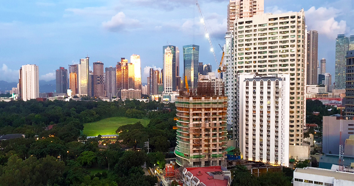
    Zero Trust Architecture is a strategy that focuses on protecting networks and systems from security risks. It has been used as a response to the exponential growth of security risks and the rapid development of new technologies. The idea proposed is that every device, user, and application should be considered untrusted unless proven otherwise. Zero Trust protects your sensitive data no matter how it travels.